Saluda Mountains
This article relies largely or entirely on a single source. (June 2020) |
| Saluda Mountains | |
|---|---|
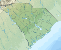
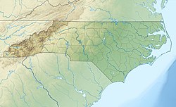 Saluda Mountains Located along the North and South Carolina border | |
| Highest point | |
| Peak | |
| Elevation | 3,258 ft (993 m) |
| Coordinates | 35°09′22″N 82°31′36″W / 35.15611°N 82.52667°WCoordinates: 35°09′22″N 82°31′36″W / 35.15611°N 82.52667°W |
| Geography | |
| Country | |
| States | North Carolina and South Carolina |
| Parent range | Blue Ridge Mountains |


The Saluda Mountains are a mountain range that straddles along the North Carolina and South Carolina border, in the southeastern United States. They are part of the Blue Ridge Province of the Southern Appalachian Mountains.[1]
Geography[]
The range begins at , near Caesars Head State Park, and go northeasterly to , near Saluda, North Carolina. Straddling the North and South Carolina state line, it is flanked by the Green and Saluda rivers.
Notable summits[]
Listed are the ten highest summits in the range.
Geology[]
This section is empty. You can help by . (July 2014) |
History[]
This section is empty. You can help by . (July 2014) |
References[]
- ^ "Saluda Mountains". Geographic Names Information System. United States Geological Survey. Retrieved July 20, 2014.
External links[]
Categories:
- Blue Ridge Mountains
- Subranges of the Appalachian Mountains
- Mountain ranges of North Carolina
- Mountain ranges of South Carolina
- Landforms of Greenville County, South Carolina
- Mountains of Henderson County, North Carolina
- Landforms of Polk County, North Carolina