Salvaterra de Magos
Salvaterra de Magos | |
|---|---|
 Flag  Coat of arms | |
 | |
| Coordinates: 39°01′N 8°47′W / 39.017°N 8.783°WCoordinates: 39°01′N 8°47′W / 39.017°N 8.783°W | |
| Country | |
| Region | Alentejo |
| Intermunic. comm. | Lezíria do Tejo |
| District | Santarém |
| Parishes | 4 |
| Government | |
| • President | (PS) |
| Area | |
| • Total | 243.93 km2 (94.18 sq mi) |
| Population (2011) | |
| • Total | 22,159 |
| • Density | 91/km2 (240/sq mi) |
| Time zone | UTC±00:00 (WET) |
| • Summer (DST) | UTC+01:00 (WEST) |
| Local holiday | Ascension Day (date varies) |
| Website | http://www.cm-salvaterrademagos.pt |

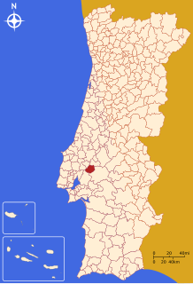
Salvaterra de Magos (Portuguese pronunciation: [ˌsalvɐˈtɛʁɐ ðɨ ˈmaɣuʃ] (![]() listen)) is a municipality in the district of Santarém in Portugal. The population in 2011 was 22,159,[1] in an area of 243.93 km².[2]
listen)) is a municipality in the district of Santarém in Portugal. The population in 2011 was 22,159,[1] in an area of 243.93 km².[2]
The present Mayor is Hélder Manuel Ramalho de Sousa Esménio of the PS. The previous mayor Ana Cristina Pardal Ribeiro, had been the only mayor elected by the Left Bloc. The municipal holiday is Ascension Day.
Notable people[]
- António Roquete (1906 in Salvaterra de Magos – 1995 in Lisbon) a football goalkeeper with 16 caps for Portugal
Climate[]
| hideClimate data for Barragem de Magos, altitude: 43 m (141 ft) | |||||||||||||
|---|---|---|---|---|---|---|---|---|---|---|---|---|---|
| Month | Jan | Feb | Mar | Apr | May | Jun | Jul | Aug | Sep | Oct | Nov | Dec | Year |
| Average precipitation mm (inches) | 90 (3.5) |
78 (3.1) |
69 (2.7) |
56 (2.2) |
50 (2.0) |
26 (1.0) |
5 (0.2) |
6 (0.2) |
29 (1.1) |
70 (2.8) |
92 (3.6) |
91 (3.6) |
662 (26) |
| Source: Portuguese Environment Agency[3] | |||||||||||||
Parishes[]
Administratively, the municipality is divided into 4 civil parishes (freguesias):[4]
References[]
- ^ Instituto Nacional de Estatística
- ^ Áreas das freguesias, concelhos, distritos e país
- ^ "Monthly Precipitation Barragem de Magos". APA. Retrieved 4 June 2021.
- ^ Diário da República. "Law nr. 11-A/2013, page 552 106" (pdf) (in Portuguese). Retrieved 30 July 2014.
External links[]
This Santarém location article is a stub. You can help Wikipedia by . |
Categories:
- Towns in Portugal
- Populated places in Santarém District
- Municipalities of Santarém District
- Santarém geography stubs