San Bernardino National Forest
This article needs additional citations for verification. (March 2012) |
| San Bernardino National Forest | |
|---|---|
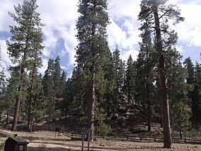 Forest near Fawnskin | |
 Map of the United States | |
| Location | San Bernardino / Riverside counties, California, United States |
| Nearest city | San Bernardino, California |
| Coordinates | 34°08′00″N 117°00′36″W / 34.13333°N 117.01000°WCoordinates: 34°08′00″N 117°00′36″W / 34.13333°N 117.01000°W |
| Area | 823,816 acres (3,333.87 km2)[1] |
| Established | 1907 |
| Governing body | U.S. Forest Service |
| Website | San Bernardino National Forest |

The San Bernardino National Forest is a United States National Forest in Southern California encompassing 823,816 acres (3,333.87 km2) of which 677,982 acres (2,743.70 km2) are federal.[1] The forest is made up of two main divisions, the eastern portion of the San Gabriel Mountains and the San Bernardino Mountains on the easternmost of the Transverse Ranges, and the San Jacinto and Santa Rosa Mountains on the northernmost of the Peninsular Ranges. Elevations range from 2,000 to 11,499 feet (600 to 3505 m). The forest includes seven wilderness areas:[2] San Gorgonio, Cucamonga, , South Fork, Santa Rosa, Cahuilla Mountain and . Forest headquarters are located in the city of San Bernardino. There are district offices in Lytle Creek, Idyllwild, and Fawnskin.
This site was the filming location for Daniel Boone in 1936; part of the 1969 musical film Paint Your Wagon was shot here.
Free camping is available at 47 different 'Yellow Post' campsites located throughout the forest.
Geography[]
According to United States Geological Survey maps of the forest, it consists of two large areas or tracts: a northern and southern portion.
The west border of the forest adjoins Angeles National Forest and runs north-south about ten miles west of Interstate 15. At its widest parts, the northern portion of the forest runs about 57 miles (90 km) on an east–west dimension. It runs about 24 miles (40 km) on a north–south dimension. This portion of the forest encompasses the San Bernardino Mountains. The area extends west of Mount San Antonio and Wrightwood in San Bernardino County. The eastern portion of the forest extends about ten miles east of Big Bear City and includes the San Gorgonio Wilderness. The southernmost portion is bisected by the Riverside County line and borders the Morongo Indian Reservation north of Cabazon.
At its widest point, the southern portion is about 27 miles (40 km) on a north-south dimension and about 30 miles (50 km) on an east-west dimension. Toro Peak and the Santa Rosa Indian Reservation are near the south extent. At the north is Snow Creek Village and the Morongo Indian Reservation. Mount San Jacinto State Wilderness is carved out of the southern portion. The community of Idyllwild is surrounded by national forest lands.
While most National Forests include lumber resources, these two areas also include:
- Residential communities and resorts
- Indian resources such as historically important caves and pictographs[3]
- The University of California-owned James Reserve research station[3]
The two tallest waterfalls in Southern California, Big Falls and Bonita Falls, are located in the San Bernardino National Forest.
Wilderness areas[]
There are seven official wilderness areas lying within San Bernardino National Forest that are part of the National Wilderness Preservation System. One extends into neighboring Angeles National Forest and three into land that is managed by the Bureau of Land Management (as indicated).
- (mostly BLM)
- Cahuilla Mountain Wilderness
- Cucamonga Wilderness (partly in Angeles NF)
- San Gorgonio Wilderness (partly BLM)
- Santa Rosa Wilderness (mostly BLM)
Esperanza Fire[]

The five-member crew (Mark Loutzenhiser, Jess McLean, Jason McKay, Daniel Hoover-Najera and Pablo Cerda) of the San Bernardino National Forest Alandale Fire Station's Engine 57 was fatally burned by a sudden, intense fire run up a steep drainage below their location during the Esperanza Fire at approximately 7:15 a.m. on October 26, 2006. All five firefighters were overrun by the fire at Twin Pines, located in the San Jacinto Mountains approximately four miles southwest of the City of Cabazon, California. The fire was located near Beaumont, California in Riverside County. Alandale station is located near the community of Idyllwild.[4][5]
Firefighting aircraft operations[]
As of 2001, eight Air Tactical Group Supervisors (ATGSs) work out of the Forest Supervisor's Office in San Bernardino. This position requires completion of an 80-hour CDF/Forest Service attack management course. A Helicopter Coordinator (J-374) course is recommended.[6]

Vegetation[]
There are many different species of trees, many coniferous, that grow in the mountains. Pines, such as ponderosa pine, Jeffrey pine, sugar pine, Coulter pine, lodgepole pine, single-leaf pinyon, and knobcone pine all thrive here. Other coniferous trees, such as white fir, bigcone Douglas-fir (Pseudotsuga macrocarpa), incense cedar, and western juniper also thrive here. Canyon live oak, California black oak, and Pacific dogwood are other trees that also grow here. The forest contains an estimated 87,400 acres (354 km2) of old growth. The most common old-growth forest types are Sierra Nevada mixed conifer forests, white fir (Abies concolor) forests, Jeffrey pine (Pinus jeffreyi) forests, and lodgepole pine (Pinus contorta) forests.[7]
See also[]
- Big Bear Lake
- Deep Creek Hot Springs
- Big Bear Discovery Center
- Fires in San Bernardino National Forest
- Valley Fire
- Cranston Fire
References[]
- ^ Jump up to: a b "Land Areas of the National Forest System" (PDF). U.S. Forest Service. Retrieved 2012-03-20.
- ^ "About the Forest". San Bernardino National Forest. Archived from the original on 2011-11-23.
- ^ Jump up to: a b Anthony, Craig E., Unit Chief, Riverside Unit Fire Management Plan 2005, (Perris, California: California Department of Forestry and Fire Protection, Riverside Unit, 2005.)
- ^ "Esperanza Fire, Accident Investigation and Factual Report" (PDF). California Department of Forestry and Fire Protection. Retrieved 2013-02-10.
- ^ "Esperanza fire fatality investigation" (PDF). Office Of Inspector General-Investigations, USDA. Retrieved 2013-02-10.
- ^ Region 5 Air Tactical and Forest Aviation Management Program: Strategic Plan, Fiscal Year 2002, (San Francisco: USDA, US Forest Service Region 5, 2001).
- ^ Warbington, Ralph; Beardsley, Debby (2002), 2002 Estimates of Old Growth Forests on the 18 National Forests of the Pacific Southwest Region, United States Forest Service, Pacific Southwest Region
Yellow Post Camp Site Info Dated Feb 2014 https://commons.wikimedia.org/wiki/File:Yellow_camp_site_info_big_bear.pdf
External links[]
| Wikimedia Commons has media related to San Bernardino National Forest. |
- Official San Bernardino National Forest website
- Local Hikes.com: Southern California Trails in the San Bernardino National Forest
- Off-Road Trails in the San Bernardino National Forest
- SBNF Supervisor's webpage (2006)
| show Authority control |
|---|
- San Bernardino National Forest
- National Forests of California
- San Bernardino Mountains
- San Jacinto Mountains
- Protected areas of Riverside County, California
- Protected areas of San Bernardino County, California
- Parks in Southern California
- Protected areas established in 1907
- 1907 establishments in California
- Protected areas of the Southern California area
- Tourist attractions in San Bernardino County, California