San Joaquín, Bolivia
show This article may be expanded with text translated from the corresponding article in German. (August 2011) Click [show] for important translation instructions. |
San Joaquín | |
|---|---|
town | |
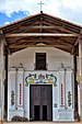
 San Joaquín Mission Church | |
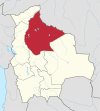
 San Joaquín Location of San Ignacio in Bolivia | |
| Coordinates: 13°02′29″S 64°40′05″W / 13.04139°S 64.66806°W | |
| Country | |
| Department | |
| Province | Mamoré Province |
| Elevation | 466 ft (142 m) |
| Population (est. 2009) | |
| • Total | 4,589 |
| Time zone | UTC-4 (BOT) |

San Joaquín is a small agricultural town in the Beni Department in the Bolivian lowlands.
It is served by San Joaquín Airport.
History[]
The Jesuit mission of San Joaquín was founded in 1709.[1] Baure Indians resided at the mission.[2]
Languages[]
Camba Spanish is the primary vernacular lingua franca spoken in the town. The Joaquiniano dialect of Baure is also spoken in San Joaquín.[3][4]
Location[]
San Joaquín is the administrative capital of Mamoré Province and is at an elevation of 142 m above sea level. It is just west of the Machupo River, a tributary of the Iténez River.
San Joaquín is 220 kilometres (140 mi) north of Trinidad, the department's capital.
Geography[]
San Joaquín is located in the Moxos Plains (Llanos de Moxos), at 100,000 km² one of the greatest wetlands of the Earth. Main vegetation in the area of San Joaquín is the tropical savanna.
Climate[]
The yearly precipitation of the region is 1,600 mm, with a distinct dry season from May to September. Monthly average temperatures vary from 24 °C und 29 °C over the year.
| hideClimate data for San Joaquin | |||||||||||||
|---|---|---|---|---|---|---|---|---|---|---|---|---|---|
| Month | Jan | Feb | Mar | Apr | May | Jun | Jul | Aug | Sep | Oct | Nov | Dec | Year |
| Average high °C (°F) | 33 (92) |
34 (93) |
34 (94) |
33 (92) |
31 (88) |
34 (93) |
34 (93) |
35 (95) |
36 (97) |
36 (96) |
33 (92) |
33 (91) |
34 (93) |
| Average low °C (°F) | 22 (72) |
22 (72) |
22 (72) |
22 (72) |
18 (65) |
19 (67) |
18 (65) |
18 (64) |
20 (68) |
21 (70) |
22 (71) |
23 (73) |
21 (69) |
| Average precipitation mm (inches) | 230 (9.2) |
220 (8.7) |
170 (6.5) |
100 (4) |
48 (1.9) |
20 (0.8) |
13 (0.5) |
28 (1.1) |
58 (2.3) |
140 (5.4) |
150 (5.8) |
220 (8.5) |
1,390 (54.7) |
| Source: Weatherbase [5] | |||||||||||||
Population[]
Over the past two decades, the town's population has risen by circa 30%, from 3,489 (census 1992) to 4,094 (census 2001) and 4,589 (2009 estimate).[6] San Joaquin has been the site of a Machupo virus or Bolivian Hemorragic Fever outbreak in the 1960s.
Notable people[]
- Jeanine Áñez, politician
References[]
- ^ Block, David (1994). Mission culture on the upper Amazon: native tradition, Jesuit enterprise, and secular policy in Moxos, 1660-1880. Lincoln: University of Nebraska Press. ISBN 0-8032-1232-1..
- ^ Meireles, Denise Maldi. 1989. Guardiães da fronteira: Rio Guaporé, século XVIII. Petrópolis: Vozes. ISBN 85-326-0017-4.
- ^ Danielsen, Swintha (2011). The personal paradigms in Baure and other South Arawakan languages. In Antoine Guillaume; Françoise Rose (eds.). International Journal of American Linguistics 77(4): 495-520.
- ^ Danielsen, Swintha; Terhart, Lena (2014). Paunaka. In Mily Crevels; Pieter Muysken (eds.). Lenguas de Bolivia, vol. III: Oriente, pp. 221-258. La Paz: Plural Editores.
- ^ "Weatherbase: Historical Weather for San Joaquin, Bolivia". Weatherbase. 2011. Retrieved on November 24, 2011.
- ^ World Gazetteer[dead link]
External links[]
Coordinates: 13°02′29″S 64°40′05″W / 13.04139°S 64.66806°W
| Authority control |
|---|
- Populated places in Beni Department
- Jesuit Missions of Moxos