Sandwick, Whalsay
| Sandwick | |
|---|---|
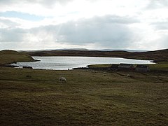 Loch of Sandwick, Whalsay, Shetland | |
 Sandwick Location within Shetland | |
| OS grid reference | HU540618 |
| Civil parish | |
| Council area | |
| Lieutenancy area | |
| Country | Scotland |
| Sovereign state | United Kingdom |
| Post town | SHETLAND |
| Postcode district | ZE2 |
| Dialling code | 01806 |
| Police | Scotland |
| Fire | Scottish |
| Ambulance | Scottish |
| UK Parliament | |
| Scottish Parliament | |

Sandwick is a hamlet, often considered part of the main village of Symbister along with adjacent , in the parish of Nesting in southwestern Whalsay in the Shetland Islands of Scotland. It is located to the south of the main centre of Symbister; Clate lies just to the south. The Holm of Sandwick lies off the coast.[1] The British military established a radar camp in the vicinity during wartime and tanks and sheds built by the military were still in use in 1986.[2] A Catalina bomber crashed in the vicinity in the early part of World War II.[2] The Loch of Sandwick lies to the west of the village. There are burnt mounds in the lake area and caves along the coast here.[3]
References[]
- ^ 544612 "Brough, HU 544 612 GB Grid". Ordnance Survey. Retrieved 1 February 2013.
{{cite web}}: Check|url=value (help) - ^ a b Cohen, Anthony Paul (1986). Symbolising Boundaries: Identity and Diversity in British Cultures. Manchester University Press. p. 15. ISBN 978-0-7190-2201-2. Retrieved 1 February 2013.
- ^ Great Britain. Scottish Development Dept; Great Britain. Scottish Office (1983*). List of ancient monuments in Scotland. HMSO, Scottish Development Dept. ISBN 9780114922894. Retrieved 5 February 2013.
{{cite book}}: Check date values in:|date=(help)
External links[]
| Wikimedia Commons has media related to Sandwick, Whalsay. |
| Settlements | ||
|---|---|---|
| Geography |
| |
| Archaeological sites | ||
| Buildings |
| |
This Shetland location article is a stub. You can help Wikipedia by . |
Categories:
- Villages in Whalsay
- Lochs of Whalsay
- Shetland geography stubs