Santa Ana, Pampanga
Santa Ana | |
|---|---|
| Municipality of Santa Ana | |
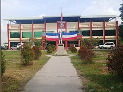 Santa Ana Town Hall | |
 Seal | |
| Nickname(s): Balen Pinpin | |
 Map of Pampanga with Santa Ana highlighted | |
OpenStreetMap  | |
 Santa Ana Location within the Philippines | |
| Coordinates: 15°05′38″N 120°46′05″E / 15.0939°N 120.7681°ECoordinates: 15°05′38″N 120°46′05″E / 15.0939°N 120.7681°E | |
| Country | Philippines |
| Region | Central Luzon |
| Province | Pampanga |
| District | 3rd district |
| Founded | January 1, 1913 [1] |
| Named for | Saint Anne |
| Barangays | 14 (see Barangays) |
| Government | |
| • Type | Sangguniang Bayan |
| • Mayor | Norberto G. Gamboa |
| • Vice Mayor | Reinhart A. Guevarra |
| • Representative | Aurelio D. Gonzales Jr. |
| • Municipal Council | Members |
| • Electorate | 32,092 voters (2019) |
| Area | |
| • Total | 39.84 km2 (15.38 sq mi) |
| Elevation | 9.0 m (29.5 ft) |
| Highest elevation | 33 m (108 ft) |
| Lowest elevation | 1 m (3 ft) |
| Population (2020 census) [4] | |
| • Total | 61,537 |
| • Density | 1,500/km2 (4,000/sq mi) |
| • Households | 10,636 |
| Economy | |
| • Income class | 3rd municipal income class |
| • Poverty incidence | 8.78% (2015)[5] |
| • Revenue | ₱174,807,196.90 (2020) |
| • Assets | ₱366,416,803.16 (2020) |
| • Expenditure | ₱135,958,096.82 (2020) |
| • Liabilities | ₱101,345,074.14 (2020) |
| Service provider | |
| • Electricity | Pampanga Rural Electric Service Cooperative (PRESCO) |
| Time zone | UTC+8 (PST) |
| ZIP code | 2022 |
| PSGC | |
| IDD : area code | +63 (0)45 |
| Native languages | Kapampangan Tagalog |

Santa Ana, officially the Municipality of Santa Ana (Kapampangan: Balen ning Santa Ana; Tagalog: Bayan ng Santa Ana), is a 3rd class municipality in the province of Pampanga, Philippines. According to the 2020 census, it has a population of 61,537 people. [4]
Barangays[]
Santa Ana is politically subdivided into 14 barangays. All of its barangays were named after various Christian patrons, although some townsfolk still use their former names.
- San Agustin (Sumpung)
- San Bartolome (Patayum)
- San Isidro (Quenabuan)
- San Joaquin (Poblacion, Canukil)
- San Jose (Catmun)
- San Juan (Tinajeru)
- San Nicolas (Sepung Ilug)
- San Pablo (Darabulbul)
- San Pedro (Calumpang)
- San Roque (Tuclung)
- Santa Lucia (Calinan)
- Santa Maria (Balen Bayu)
- Santiago (Barrio Libutad)
- Santo Rosario (Pagbatuan)
Climate[]
| Climate data for Santa Ana, Pampanga | |||||||||||||
|---|---|---|---|---|---|---|---|---|---|---|---|---|---|
| Month | Jan | Feb | Mar | Apr | May | Jun | Jul | Aug | Sep | Oct | Nov | Dec | Year |
| Average high °C (°F) | 28 (82) |
29 (84) |
31 (88) |
33 (91) |
32 (90) |
31 (88) |
30 (86) |
29 (84) |
29 (84) |
30 (86) |
30 (86) |
28 (82) |
30 (86) |
| Average low °C (°F) | 20 (68) |
20 (68) |
21 (70) |
23 (73) |
24 (75) |
24 (75) |
24 (75) |
24 (75) |
24 (75) |
23 (73) |
22 (72) |
21 (70) |
23 (72) |
| Average precipitation mm (inches) | 6 (0.2) |
4 (0.2) |
6 (0.2) |
17 (0.7) |
82 (3.2) |
122 (4.8) |
151 (5.9) |
123 (4.8) |
124 (4.9) |
99 (3.9) |
37 (1.5) |
21 (0.8) |
792 (31.1) |
| Average rainy days | 3.3 | 2.5 | 3.6 | 6.6 | 17.7 | 22.2 | 25.2 | 23.7 | 23.2 | 17.9 | 9.2 | 5.2 | 160.3 |
| Source: Meteoblue [6] | |||||||||||||
Demographics[]
|
| |||||||||||||||||||||||||||||||||||||||||||||||||||
| Source: Philippine Statistics Authority [7] [8] [9][10] | ||||||||||||||||||||||||||||||||||||||||||||||||||||
In the 2020 census, the population of Santa Ana, Pampanga, was 61,537 people, [4] with a density of 1,500 inhabitants per square kilometre or 3,900 inhabitants per square mile.
Economy[]
| Poverty Incidence of Santa Ana | |
| Source: Philippine Statistics Authority[11][12][13][14][15][16] | |
Local government[]
The municipal government is divided into three branches: executive, legislative and judiciary. The judicial branch is administered solely by the Supreme Court of the Philippines. The executive branch is composed of the mayor and the barangay captain for the barangays. The legislative branch is composed of the Sangguniang Bayan (town assembly), Sangguniang Barangay (barangay council), and the Sangguniang Kabataan for the youth sector.
Education[]
Private schools[]
- Holy Cross College (Pampanga)
- Saint Mary's Angels College of Pampanga
- Adelle Grace Montesorri School Inc. Santa Ana
Public secondary schools[]
- Sta Ana National High School
- San Isidro High School
- Telesforo and Natividad Alfonso High School
Elementary schools[]
- Fulgencio Matias Elementary School – San Joaquin
- San Juan/San Pedro Elementary School – San Pedro
- San Agustin Elementary School – San Agustin
- Sto Rosario Elementary School – Sto Rosario
- San Roque Elementary School – San Roque
- San Pablo Elementary School – San Pablo
- Santiago Elementary School – Santiago
- San Isidro Elementary School – San Isidro
- San Nicolas Elementary School – San Nicolas
- Sta Lucia Elementary School – Sta Lucia
- Sta Maria Elementary School – Sta Maria
- Sta. Ana Elementary School - Sta. Lucia, Sta. Ana
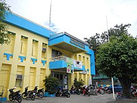
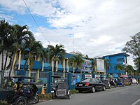
Gallery[]
Town hall

Public market

St. Anne Parish Church

Saint Mary's Angels College
Holy Cross College


References[]
- ^ http://pampanga.gov.ph/index.php/component/content/article/189-capitol/tourism/municipality/320-sta-ana.html
- ^ Municipality of Santa Ana | (DILG)
- ^ "2015 Census of Population, Report No. 3 – Population, Land Area, and Population Density" (PDF). Philippine Statistics Authority. Quezon City, Philippines. August 2016. ISSN 0117-1453. Archived (PDF) from the original on May 25, 2021. Retrieved July 16, 2021.
- ^ a b c Census of Population (2020). "Region III (Central Luzon)". Total Population by Province, City, Municipality and Barangay. PSA. Retrieved 8 July 2021.
- ^ https://psa.gov.ph/sites/default/files/City%20and%20Municipal-level%20Small%20Area%20Poverty%20Estimates_%202009%2C%202012%20and%202015_0.xlsx; publication date: 10 July 2019; publisher: Philippine Statistics Authority.
- ^ "Santa Ana: Average Temperatures and Rainfall". Meteoblue. Retrieved 5 May 2020.
- ^ Census of Population (2015). "Region III (Central Luzon)". Total Population by Province, City, Municipality and Barangay. PSA. Retrieved 20 June 2016.
- ^ Census of Population and Housing (2010). "Region III (Central Luzon)". Total Population by Province, City, Municipality and Barangay. NSO. Retrieved 29 June 2016.
- ^ Censuses of Population (1903–2007). "Region III (Central Luzon)". Table 1. Population Enumerated in Various Censuses by Province/Highly Urbanized City: 1903 to 2007. NSO.
- ^ "Province of Pampanga". Municipality Population Data. Local Water Utilities Administration Research Division. Retrieved 17 December 2016.
- ^ "Poverty incidence (PI):". Philippine Statistics Authority. Retrieved 28 December 2020.
- ^ https://psa.gov.ph/sites/default/files/NSCB_LocalPovertyPhilippines_0.pdf; publication date: 29 November 2005; publisher: Philippine Statistics Authority.
- ^ https://psa.gov.ph/sites/default/files/2003%20SAE%20of%20poverty%20%28Full%20Report%29_1.pdf; publication date: 23 March 2009; publisher: Philippine Statistics Authority.
- ^ https://psa.gov.ph/sites/default/files/2006%20and%202009%20City%20and%20Municipal%20Level%20Poverty%20Estimates_0_1.pdf; publication date: 3 August 2012; publisher: Philippine Statistics Authority.
- ^ https://psa.gov.ph/sites/default/files/2012%20Municipal%20and%20City%20Level%20Poverty%20Estima7tes%20Publication%20%281%29.pdf; publication date: 31 May 2016; publisher: Philippine Statistics Authority.
- ^ https://psa.gov.ph/sites/default/files/City%20and%20Municipal-level%20Small%20Area%20Poverty%20Estimates_%202009%2C%202012%20and%202015_0.xlsx; publication date: 10 July 2019; publisher: Philippine Statistics Authority.
External links[]
| Wikimedia Commons has media related to Santa Ana, Pampanga. |
- Santa Ana Profile at PhilAtlas.com
- Philippine Standard Geographic Code
- Philippine Census Information
- Local Governance Performance Management System
San Fernando (capital) | |
| Municipalities | |
| Component cities | |
| Highly urbanized city |
|
- Municipalities of Pampanga