Santa María Chiquimula
Santa María Chiquimula | |
|---|---|
Municipality | |
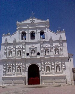 Catholic church of Santa María Chiquimula | |
 Santa María Chiquimula within Totonicapán | |
 Totonicapán within Guatemala | |
| Coordinates: 15°01′45″N 91°19′46″W / 15.02917°N 91.32944°W | |
| Country | |
| Department | |
| Government | |
| • Type | Municipal |
| Area | |
| • Total | 236 km2 (91 sq mi) |
| Elevation | 2,130 m (6,990 ft) |
| Population (2018 census)[1] | |
| • Total | 55,013 |
| • Density | 230/km2 (600/sq mi) |
| • Ethnicities | K'iche' Ladino |
| • Religions | Catholicism Evangelicalism Maya |
| Climate | Cwb |
| Website | Official site |

Santa María Chiquimula is a town, with a population of 15,919 (2018 census),[3] and a municipality in the Totonicapán department of Guatemala. Located in the western highlands of Guatemala at an altitude of 2130 metres.[2] The municipality has an area of 236 km2 (91 sq mi) and a population of 55,013 (2018 census). The Mayan K’iche’ language is spoken among the indigenous people here, but Spanish is also widely spoken. The main products of the region are corn and black beans.

Welcome sign for Santa María Chiquimula, 2004-04-16
Dialect[]
The K'iche' spoken in Santa María Chiquimula is marked by intervocalic l transitioning into ð, especially among women.[4]
References[]
- ^ Citypopulation.de Population of Department and municipalities in Guatemala
- ^ Jump up to: a b "Santa María Chiquimula. Datos geográficos". Municipalidad de Santa María Chiquimula. Archived from the original on 2012-02-18. Retrieved 2012-02-28.
- ^ Population of cities & towns in Guatemala
- ^ Romero, Sergio (2015). "3". Language and Ethnicity among the K'ichee' Maya. p. 42.
External links[]
 Media related to Santa María Chiquimula at Wikimedia Commons

| show Authority control |
|---|
This Guatemala location article is a stub. You can help Wikipedia by . |
Categories:
- Municipalities of the Totonicapán Department
- Guatemala geography stubs