Santiponce
Santiponce | |
|---|---|
 | |
 Flag  Coat of arms | |
 Santiponce | |
| Coordinates: 37°26′7″N 6°2′36″W / 37.43528°N 6.04333°WCoordinates: 37°26′7″N 6°2′36″W / 37.43528°N 6.04333°W | |
| Country | |
| Autonomous community | |
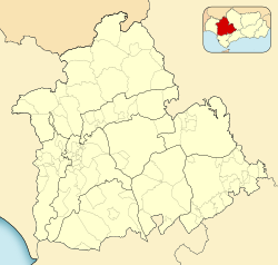
| Province | Seville |
| Comarca | |
| Judicial district | Santiponce |
| Government | |
| • Mayor | (PSOE-A) |
| Area | |
| • Total | 8.38 km2 (3.24 sq mi) |
| Elevation | 18 m (59 ft) |
| Population (2018)[1] | |
| • Total | 8,442 |
| • Density | 1,000/km2 (2,600/sq mi) |
| Demonym(s) | Poncino |
| Time zone | UTC+1 (CET) |
| • Summer (DST) | UTC+2 (CEST) |
| Postal code | 41970 |
| Official language(s) | Spanish |


Santiponce is a town located in the province of Seville, Spain. According to the 2006 census (INE), the town has a population of 7742 inhabitants.[2]
The town contains the ruins of the Roman city Italica.
References[]
- ^ Municipal Register of Spain 2018. National Statistics Institute.
- ^ "Santiponce - Sistema de Información Multiterritorial de Andalucía". Instituto de Estadística de Andalucía. Junta de Andalucía. Archived from the original on 17 August 2007. Retrieved 24 November 2019.
| Wikimedia Commons has media related to Santiponce. |
| show Authority control |
|---|
This article about a location in Andalusia, Spain, is a stub. You can help Wikipedia by . |
Categories:
- Municipalities of the Province of Seville
- Andalusia geography stubs