Scald Law
| Scald Law | |
|---|---|
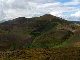 Scald Law as seen from the northeast | |
| Highest point | |
| Elevation | 579 m (1,900 ft) |
| Prominence | c. 312 m (1,024 ft) |
| Listing | Marilyn, Hardy |
| Coordinates | 55°50′09″N 3°17′24″W / 55.8357°N 3.2901°WCoordinates: 55°50′09″N 3°17′24″W / 55.8357°N 3.2901°W |
| Geography | |
| Location | Midlothian, Scotland |
| OS grid | NT191610 |
| Topo map | OS Landranger 65 |
| Climbing | |
| Easiest route | Hike |

Scald Law is a hill in Midlothian, Scotland. At 579 metres (1900 feet) it is the highest of the Pentland Hills. The hill is composed of Devonian volcanic rock.
Etymology[]
The origin of the name is uncertain. Some sources say it derives from the Scots Language word scawed, meaning "bare."[1] Others suggest that it derived from the Old Norse word sgat (meaning "rent") as cattle were pastured on the hill on payment of a rent.[2] A further explanation is that it derives from scaldberry, an old name for blackberry.[3][4] The word law is derived from the Old English for hill.
References[]
- ^ Glossary of Scots origins of place names in Britain (N to Y)
- ^ Milne, John (1912). Gaelic Placenames of the Lothians (PDF). Mcdougall's Educational Company. p. 43.
- ^ http://download.edinburgh.gov.uk/Pentlands/Pentland_Place_Names.doc[bare URL]
- ^ Dixon, Norman (1947). The Placenames of Midlothian (PDF) (Thesis). University of Edinburgh. pp. 27, 45, 46, 240. Retrieved 13 September 2021.
External links[]
 Media related to Scald Law at Wikimedia Commons
This Midlothian location article is a stub. You can help Wikipedia by . |
Categories:
- Mountains and hills of Midlothian
- Hills of the Scottish Midland Valley
- Volcanism of Scotland
- Devonian volcanism
- Marilyns of Scotland
- Lothians geography stubs