Schlagsdorf
Schlagsdorf | |
|---|---|
 Part of the former Inner German border preserved at Museum Grenzhus in Schlagsdorf | |
 Coat of arms | |
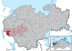
show Location of Schlagsdorf within Nordwestmecklenburg district | |
 Schlagsdorf | |
| Coordinates: 53°43′N 10°49′E / 53.717°N 10.817°ECoordinates: 53°43′N 10°49′E / 53.717°N 10.817°E | |
| Country | Germany |
| State | Mecklenburg-Vorpommern |
| District | Nordwestmecklenburg |
| Municipal assoc. | Rehna |
| Government | |
| • Mayor | Ingo Melchin |
| Area | |
| • Total | 20.12 km2 (7.77 sq mi) |
| Elevation | 39 m (128 ft) |
| Population (2020-12-31)[1] | |
| • Total | 1,190 |
| • Density | 59/km2 (150/sq mi) |
| Time zone | UTC+01:00 (CET) |
| • Summer (DST) | UTC+02:00 (CEST) |
| Postal codes | 19217 |
| Dialling codes | 038875 |
| Vehicle registration | NWM |


Schlagsdorf is a municipality in the Nordwestmecklenburg district, in Mecklenburg-Vorpommern, Germany.
References[]
- ^ "Statistisches Amt M-V – Bevölkerungsstand der Kreise, Ämter und Gemeinden 2020". Statistisches Amt Mecklenburg-Vorpommern (in German). July 2021.
| show Towns and municipalities in Nordwestmecklenburg |
|---|
| Authority control |
|---|
This Nordwestmecklenburg location article is a stub. You can help Wikipedia by . |
Categories:
- Municipalities in Mecklenburg-Vorpommern
- Nordwestmecklenburg
- Grand Duchy of Mecklenburg-Strelitz
- Bezirk Schwerin
- Nordwestmecklenburg geography stubs