Schlaiten
Schlaiten | |
|---|---|
 Coat of arms | |
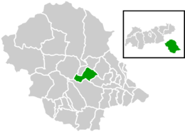 Location within Lienz district | |
 Schlaiten Location within Austria | |
| Coordinates: 46°52′38″N 12°39′21″E / 46.87722°N 12.65583°ECoordinates: 46°52′38″N 12°39′21″E / 46.87722°N 12.65583°E | |
| Country | Austria |
| State | Tyrol |
| District | Lienz |
| Government | |
| • Mayor | Erich Gliber (HLS) |
| Area | |
| • Total | 36.64 km2 (14.15 sq mi) |
| Elevation | 876 m (2,874 ft) |
| Population (2018-01-01)[2] | |
| • Total | 474 |
| • Density | 13/km2 (34/sq mi) |
| Time zone | UTC+1 (CET) |
| • Summer (DST) | UTC+2 (CEST) |
| Postal code | 9954 |
| Area code | 4853 |
| Vehicle registration | LZ |

Schlaiten is a municipality in the district of Lienz in the Austrian state of Tyrol. Its name is of Slavonic origin, deriving from *slatina, which means swamp. The municipality consists of the following neighbourhoods: Plone, Gonzach, Mesnerdorf, Bacherdorf, Gantschach and Göriach.
Population[]
| Year | Pop. | ±% |
|---|---|---|
| 1869 | 337 | — |
| 1880 | 339 | +0.6% |
| 1890 | 317 | −6.5% |
| 1900 | 289 | −8.8% |
| 1910 | 302 | +4.5% |
| 1923 | 293 | −3.0% |
| 1934 | 330 | +12.6% |
| 1939 | 323 | −2.1% |
| 1951 | 345 | +6.8% |
| 1961 | 431 | +24.9% |
| 1971 | 447 | +3.7% |
| 1981 | 453 | +1.3% |
| 1991 | 466 | +2.9% |
| 2001 | 498 | +6.9% |
| 2012 | 468 | −6.0% |
References[]
- ^ "Dauersiedlungsraum der Gemeinden Politischen Bezirke und Bundesländer - Gebietsstand 1.1.2018". Statistics Austria. Retrieved 10 March 2019.
- ^ "Einwohnerzahl 1.1.2018 nach Gemeinden mit Status, Gebietsstand 1.1.2018". Statistics Austria. Retrieved 9 March 2019.
| Wikimedia Commons has media related to Schlaiten. |
| Authority control |
|---|
This Tyrol location article is a stub. You can help Wikipedia by . |
Categories:
- Cities and towns in Lienz District
- Tyrol geography stubs