Schlettau
show This article may be expanded with text translated from the corresponding article in German. (August 2012) Click [show] for important translation instructions. |
Schlettau | |
|---|---|
 Church in Schlettau | |
 Coat of arms | |
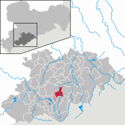
show Location of Schlettau within Erzgebirgskreis district | |
 Schlettau | |
| Coordinates: 50°33′31″N 12°57′4″E / 50.55861°N 12.95111°ECoordinates: 50°33′31″N 12°57′4″E / 50.55861°N 12.95111°E | |
| Country | Germany |
| State | Saxony |
| District | Erzgebirgskreis |
| Municipal assoc. | Scheibenberg-Schlettau |
| Government | |
| • Mayor (2015–22) | Conny Göckeritz[1] (Greens) |
| Area | |
| • Total | 21.17 km2 (8.17 sq mi) |
| Elevation | 612 m (2,008 ft) |
| Population (2020-12-31)[2] | |
| • Total | 2,345 |
| • Density | 110/km2 (290/sq mi) |
| Time zone | UTC+01:00 (CET) |
| • Summer (DST) | UTC+02:00 (CEST) |
| Postal codes | 09487 |
| Dialling codes | 03733 |
| Vehicle registration | ERZ, ANA, ASZ, AU, MAB, MEK, STL, SZB, ZP |
| Website | www.schlettau.de |


Schlettau is a town in the district of Erzgebirgskreis, in Saxony in Germany. It is situated in the Ore Mountains, 5 km southwest of Annaberg-Buchholz, and 12 km east of Schwarzenberg.

Reuther house

1936
References[]
- ^ Bürgermeisterwahlen 2015, Freistaat Sachsen, accessed 12 July 2021.
- ^ "Bevölkerung des Freistaates Sachsen nach Gemeinden am 31. Dezember 2020". Statistisches Landesamt des Freistaates Sachsen (in German). June 2021.
| show Towns and municipalities in Erzgebirgskreis |
|---|
| show Authority control |
|---|
This Erzgebirgskreis location article is a stub. You can help Wikipedia by . |
Categories:
- Towns in Saxony
- Erzgebirgskreis
- Bezirk Karl-Marx-Stadt
- Saxony geography stubs