Schneverdingen
Schneverdingen | |
|---|---|
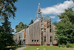 One World Church | |
 Coat of arms | |
show Location of Schneverdingen within Heidekreis district | |
 Schneverdingen | |
| Coordinates: 53°07′00″N 09°48′00″E / 53.11667°N 9.80000°ECoordinates: 53°07′00″N 09°48′00″E / 53.11667°N 9.80000°E | |
| Country | Germany |
| State | Lower Saxony |
| District | Heidekreis |
| Subdivisions | 10 districts |
| Government | |
| • Mayor | Meike Moog-Steffens (Ind.) |
| Area | |
| • Total | 234.58 km2 (90.57 sq mi) |
| Elevation | 97 m (318 ft) |
| Population (2020-12-31)[1] | |
| • Total | 18,881 |
| • Density | 80/km2 (210/sq mi) |
| Time zone | UTC+01:00 (CET) |
| • Summer (DST) | UTC+02:00 (CEST) |
| Postal codes | 29640 |
| Dialling codes | 05193, -98, -99, 04265 |
| Vehicle registration | SFA/HK |
| Website | www.schneverdingen.de |


Schneverdingen (German pronunciation: [ˈʃneːvɐdɪŋən]; Low Saxon Snevern) is a city in the northern part of the district of Heidekreis, in Lower Saxony, Germany. It is located in the area known as Lüneburg Heath.
Geography[]
Location[]
Schneverdingen is situated approximately 15 km (9 mi) north of Soltau, and 50 km (31 mi) south of Hamburg.
History[]
Schneverdingen belonged to the Prince-Bishopric of Verden, established in 1180. In 1648 the Prince-Bishopric was transformed into the Principality of Verden, which was first ruled in personal union by the Swedish Crown - interrupted by a Danish occupation (1712–1715) - and from 1715 on by the Hanoverian Crown. The Kingdom of Hanover incorporated the Principality in a real union and the Princely territory, including Schneverdingen, became part of the new Stade Region, established in 1823.
Government[]
Town twinning[]
Schneverdingen is twinned with:
Places of interest[]
- Höpen Airfield
- Reinsehlen Camp
- Heidegarten
- Pietzmoor
References[]
External links[]
| Wikimedia Commons has media related to Schneverdingen. |
| Wikivoyage has a travel guide for Schneverdingen. |
| show Towns and municipalities in Heidekreis |
|---|
| show Authority control |
|---|
- Towns in Lower Saxony
- Heidekreis