Schwarzenfeld
Schwarzenfeld | |
|---|---|
 Aerial view of the town | |
 Coat of arms | |
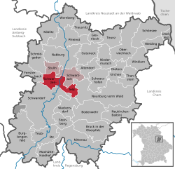
show Location of Schwarzenfeld within Schwandorf district | |
 Schwarzenfeld | |
| Coordinates: 49°23′N 12°8′E / 49.383°N 12.133°ECoordinates: 49°23′N 12°8′E / 49.383°N 12.133°E | |
| Country | Germany |
| State | Bavaria |
| Admin. region | Oberpfalz |
| District | Schwandorf |
| Municipal assoc. | Schwarzenfeld |
| Government | |
| • Mayor (2020–26) | Peter Neumeier[1] (FW) |
| Area | |
| • Total | 38.27 km2 (14.78 sq mi) |
| Highest elevation | 415 m (1,362 ft) |
| Lowest elevation | 360 m (1,180 ft) |
| Population (2020-12-31)[2] | |
| • Total | 6,319 |
| • Density | 170/km2 (430/sq mi) |
| Time zone | UTC+01:00 (CET) |
| • Summer (DST) | UTC+02:00 (CEST) |
| Postal codes | 92521 |
| Dialling codes | 0 94 35 |
| Vehicle registration | SAD |
| Website | www.schwarzenfeld.de |


Schwarzenfeld is a municipality in the district of Schwandorf in Bavaria, Germany.
The melodic death metal band Deadlock is based in this municipality.
Climate[]
| ||||||||||||||||||||||||||||||||||||||||||||||||||||||||||||||||||||||||||||
Notable buildings[]

Church of the Virgin Mary and Town Hall in Schwarzenfeld
References[]
- ^ Liste der ersten Bürgermeister/Oberbürgermeister in kreisangehörigen Gemeinden, Bayerisches Landesamt für Statistik, 15 July 2021.
- ^ "Tabellenblatt "Daten 2", Statistischer Bericht A1200C 202041 Einwohnerzahlen der Gemeinden, Kreise und Regierungsbezirke". Bayerisches Landesamt für Statistik (in German). June 2021.
- ^ "NASA Earth Observations Data Set Index". NASA. Retrieved 30 January 2016.
| show Towns and municipalities in Schwandorf (district) |
|---|
| Authority control |
|---|
This Schwandorf district location article is a stub. You can help Wikipedia by . |
Categories:
- Municipalities in Bavaria
- Schwandorf (district)
- Upper Palatinate geography stubs