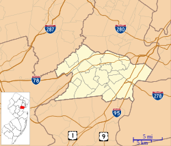
Scotch Plains Baptist Church
| Scotch Plains Baptist Church | |
|---|---|
 | |
 | |
| General information | |
| Architectural style | |
| Town or city | Park Avenue, Scotch Plains, New Jersey |
| Country | United States |
| Construction started | 1870 (for present church)[1] |
| Completed | c.1740 (for 1st church)[1] c.1816 (for 2nd church)[1] 1870 (for 3rd and present church)[1] |
| Demolished | 1816 (fire--1st church)[1] |
| Client | Scotch Plains Baptist Church |
| Technical details | |
| Structural system | Masonry brick with Ohio stone dressing[1] |
Scotch Plains Baptist Church, Parsonage, and Cemetery | |
 | |
| Location | 333-347 Park Ave. Scotch Plains, New Jersey |
| Coordinates | 40°39′9″N 74°23′59″W / 40.65250°N 74.39972°W |
| Architect | Thomas A. Roberts |
| Architectural style | Late Victorian: Gothic; Colonial: Georgian |
| NRHP reference No. | 13000386[2] |
| Added to NRHP | June 14, 2013 |
Scotch Plains Baptist Church is a historic Baptist church located at Park Avenue in Scotch Plains, New Jersey. The associated nearby Old Baptist Parsonage is a historic church parsonage, located at 347 Park Avenue, which was built in 1786 and listed on the National Register of Historic Places in 1973.[2]
History[]
The present church is located in an American Revolutionary War-era cemetery known as "God’s Little Acre", with Watchung Mountains-quarried brown sandstone grave markers dating back to 1742.[1] The original church dated from the early 18th century. After a fire, it was rebuilt around 1816.[1] The present church was built in 1871 in a Gingerbread Ruskinian Gothic style “made of pressed brick with Ohio stone and white brick trimmings.”[1]
Buried the church's cemetery is Caesar, who died on February 7, 1806 at 104 years of age. He was born in Africa and brought to America as a slave. He was freed from slavery in 1769. During the Revolutionary War Caesar drove a wagon and delivered supplies to the Continental troops at Blue Hills Fort and Camp.
References[]
- ^ Jump up to: a b c d e f g h i Bousquet, R; S. Bousquet (1995). Scotch Plains and Fanwood. Images of America. Dover, New Hampshire: Arcadia Publishing. ISBN 0-7385-6318-8.
- ^ Jump up to: a b "Scotch Plains Baptist Church, Parsonage, and Cemetery; National Register of Historic Places Program". National Park Service. Retrieved August 30, 2017.
External links[]
- Baptist churches in New Jersey
- Churches completed in 1870
- Churches in Union County, New Jersey
- Gothic Revival church buildings in New Jersey
- Churches completed in 1816
- Demolished churches in the United States
- Scotch Plains, New Jersey
- Burned religious buildings and structures in the United States
- Demolished buildings and structures in New Jersey
- National Register of Historic Places in Union County, New Jersey


