Sefwi Akontombra District
Sefwi-Akontombra District | |
|---|---|
 Districts of Western North Region | |
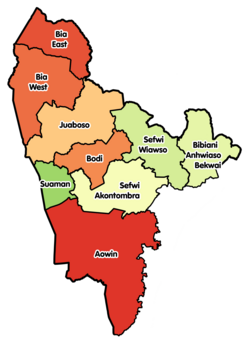
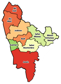
 Sefwi-Akontombra District Location of Sefwi-Akontombra District within Western North | |
| Coordinates: 6°2′8″N 2°52′30″W / 6.03556°N 2.87500°W | |
| Country | |
| Region | |
| Capital | Akontombra |
| Government | |
| • District Executive | Hon. |
| • Succeeded | Hon. |
| Area | |
| • Total | 1,157 km2 (447 sq mi) |
| Population (2021 census) | |
| • Total | 70,225 |
| • Density | 61/km2 (160/sq mi) |
| Time zone | UTC+0 (GMT) |
| ISO 3166 code | GH-WN-SA |
Sefwi-Akontombra District is one of the nine districts in Western North Region, Ghana.[1] Originally it was formerly part of the then-larger Sefwi-Wiawso District in 1988, which was created from the former Sefwi-Bibiani District Council, until the southwest part of the district was split off to create Sefwi-Akontombra District on 29 February 2008; thus the remaining part was retained as Sefwi-Wiawso District (which it was later elevated to municipal district assembly status on March 2012 (effectively 28 June 2012) to become Sefwi-Wiawso Municipal District). The district assembly is located in the northeast part of Western North Region and has Akontombra as its capital town.
Sources[]
- "Districts of Ghana". Statoids.
- GhanaDistricts.com
References[]
- ^ michael ocansey. "A repository of all districts in the republic of Ghana". Ghana Districts. Archived from the original on 2012-03-23. Retrieved 2012-05-17.
Categories:
- Districts of the Western North Region
- Ghana geography stubs

