Sengerema District
Sengerema District | |
|---|---|
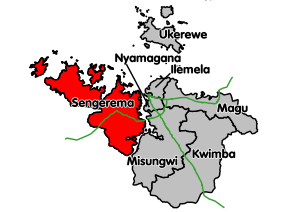 Sengerema location within Mwanza Region. Trunk roads in green. | |
| Coordinates: 02°20′S 032°30′E / 2.333°S 32.500°ECoordinates: 02°20′S 032°30′E / 2.333°S 32.500°E | |
| Country | Tanzania |
| Region | Mwanza Region |
| UFI | -2573399 |

Sengerema District[1] is one of seven districts in the Mwanza Region of Tanzania, East Africa. It is bordered to the north and east by Lake Victoria, to the south by Geita Region and to the southeast by the Misungwi District.
As of 2002, the population of Sengerema District was 501,915.[2] The district's population has grown to 663,034 in 2012.[3]
Administrative subdivisions[]
Constituencies[]
For parliamentary elections, Tanzania is divided into constituencies. As of the 2010 elections Sengerema District had two constituencies:[4]
- Buchosa Constituency
- Sengerema Constituency
Divisions[]
Sengerema District is administratively divided into divisions.
Wards[]
As of 2002, Sengerema District was administratively divided into twenty-five wards.[2] As of 2012, it was divided into thirty-four wards, after some reorganization.[5]
2002 wards[]
|
|
|
2012 wards[]
|
|
Notes[]
- ^ Sengerema District (Approved) at GEOnet Names Server, United States National Geospatial-Intelligence Agency
- ^ Jump up to: a b "2002 Population and Housing Census: General Report: Mwanza: Sengerema". Archived from the original on 20 March 2004.
- ^ "Census 2012". National Bureau of Statistics. Archived from the original on 5 March 2016. Retrieved 11 December 2015.
- ^ "Organisations located in Sengerema District - Tanzania". African Development Information.
- ^ "Postcodes Mwanza Region 33000" (PDF). Tanzania Communications Regulatory Authority (TCRA). 2012.
| show Authority control |
|---|
Categories:
- Sengerema District
- Districts of Mwanza Region