Sertã
Sertã | |
|---|---|
 Flag  Coat of arms | |
 | |
| Coordinates: 39°48′N 8°06′W / 39.80°N 8.10°WCoordinates: 39°48′N 8°06′W / 39.80°N 8.10°W | |
| Country | |
| Region | Centro |
| Intermunic. comm. | Médio Tejo |
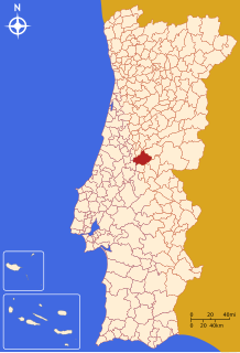
| District | Castelo Branco |
| Parishes | 10 |
| Government | |
| • President | José Farinha Nunes (PSD) |
| Area | |
| • Total | 446.73 km2 (172.48 sq mi) |
| Elevation | 250 m (820 ft) |
| Population (2011) | |
| • Total | 15,880 |
| • Density | 36/km2 (92/sq mi) |
| Time zone | UTC±00:00 (WET) |
| • Summer (DST) | UTC+01:00 (WEST) |
| Postal code | 6100 |
| Area code | (+351) 274 |
| Local holiday | Birthday of Nuno Álvares Pereira, 24 June |
| Website | Official website (in Portuguese) |

Sertã (Portuguese pronunciation: [sɨɾˈtɐ̃] (![]() listen)) is a municipality in Castelo Branco District in Portugal. The population in 2011 was 15,880,[1] in an area of 446.73 km².[2]
listen)) is a municipality in Castelo Branco District in Portugal. The population in 2011 was 15,880,[1] in an area of 446.73 km².[2]
The present mayor is José Farinha Nunes, elected by the PSD. The municipal holiday is the June 24.
| Population of Sertã (1801 – 2011) | ||||||||
|---|---|---|---|---|---|---|---|---|
| 1801 | 1849 | 1900 | 1930 | 1960 | 1981 | 1991 | 2001 | 2011 |
| 10235 | 13456 | 20380 | 24057 | 27997 | 21503 | 18199 | 16720 | 15880 |
General information[]
Local sports club: Sertanense Futebol Clube (mainly devoted to soccer, playing (2004-2005) the 3rd Division Championship).
Local newspaper: A Comarca da Sertã (weekly)
Parishes[]
Administratively, the municipality is divided into 10 civil parishes (freguesias):[3]
Parish name Population (2011)[1] Area km²[2] 957 10.39 465 10.02 1,046 24.57 Cernache do Bonjardim, Nesperal e Palhais 3,625 101.58 731 51.73 423 42.74 753 36.86 Sertã 6,196 80.95 864 53.37 820 34.51
Notable people[]
- Nuno Álvares Pereira (born 1360 in Cernache de Bonjardim - 1431) a Portuguese general, he became a mystic and was beatified by Pope Benedict XV, in 1918, and canonised by Pope Benedict XVI in 2009
- João Castel-Branco Goulão (born 1954 in Cernache do Bonjardim) a physician and the current national drug coordinator for Portugal
References[]
- ^ Jump up to: a b Instituto Nacional de Estatística
- ^ Jump up to: a b Eurostat
- ^ Diário da República. "Law nr. 11-A/2013, page 552 114" (pdf) (in Portuguese). Retrieved 31 July 2014.
| Wikimedia Commons has media related to Sertã. |
| Authority control |
|---|
This Castelo Branco location article is a stub. You can help Wikipedia by . |
Categories:
- Populated places in Castelo Branco District
- Municipalities of Castelo Branco District
- People from Sertã
- Portugal geography stubs