Sevsk, Bryansk Oblast
Sevsk
Севск | |
|---|---|
Town[1] | |
 Coat of arms | |
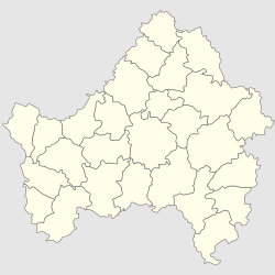
show Location of Sevsk | |
 Sevsk Location of Sevsk | |
| Coordinates: 52°09′N 34°30′E / 52.150°N 34.500°ECoordinates: 52°09′N 34°30′E / 52.150°N 34.500°E | |
| Country | Russia |
| Federal subject | Bryansk Oblast[1] |
| Administrative district | Sevsky District[2] |
| Urban Administrative Okrug | Sevsky[2] |
| First mentioned | 1146 |
| Elevation | 170 m (560 ft) |
| Population | |
| • Total | 7,282 |
| • Estimate (2018)[4] | 6,663 (−8.5%) |
Administrative status | |
| • Capital of | Sevsky District[1], Sevsky Urban Administrative Okrug[2] |
Municipal status | |
| • Municipal district | Sevsky Municipal District[5] |
| • Urban settlement | Sevskoye Urban Settlement[5] |
| • Capital of | Sevsky Municipal District[5], Sevskoye Urban Settlement[5] |
| Time zone | UTC+3 (MSK |
| Postal code(s)[7] | 242440 |
| OKTMO ID | 15648101001 |


Sevsk (Russian: Севск) is a town and the administrative center of Sevsky District in Bryansk Oblast, Russia, located on the (Dnieper's basin), 142 kilometers (88 mi) from Bryansk, the administrative center of the oblast. Population: 7,282 (2010 Census);[3] 7,660 (2002 Census);[8] 7,820 (1989 Census).[9]
History[]
Principality of Chernigov 1146–1356
Grand Duchy of Lithuania 1356–1569
Polish–Lithuanian Commonwealth 1569–1585
Tsardom of Russia 1585–1721
Russian Empire 1721–1917
Russian Republic 1917
Soviet Russia 1917–1922
Soviet Union 1922–1991
Sevsk is one of the oldest cities in the Bryansk region. Along with Novgorod-Seversky, Putivlem and Rylsk, it was one of the cities of the historical Severshchina. Archaeological research indicates the early settlement of the territory of Sevsk. Sevsk is first mentioned under 1146 in two chronicles — and Ipatievskaya. At that time, the city was part of the Chernihiv-Seversk land. In the reign of Ivan the Terrible was fortified, garrison reinforced by , who created a Cossack sloboda here. In the middle of the 17th century a Sev fortress was included in the system of newly created defensive guards along the south-western borders. The convenient location contributed to the creation of a strong fortress here, which played a significant role in the history of Russia. Sevsk was known as a major shopping center not only in Russia, but also in the West. In 1634, the from the Poles played an important role in ending the The Smolensk War. After 1683 and the city grew many times at the expense of streltsy and other , sent here from Moscow after . At the end of the XVII century, a silver coin was minted in Sevsk for that became part of Russia — . In 1687 at Sevsk, the 32nd [[Chernihiv Colonel] was beheaded]] (son of hetman a Ivan Samoilovich). In the XVIII century, the defensive importance of Sevsk as a border town weakened, as the borders were moved to the south and west. It organizes the civil administration. The city was granted a coat of arms and a general development plan. Military people are settling on the outskirts of the city. In Sevsk and its environs, there are still Streletskaya, Pushkarnaya, Soldatskaya Sloboda, and the village of . With the division of Russia into provinces, Sevsk was included in the , in which in 1719 became the center of , which included 9 cities: Sevsk, Trubchevsk, Bryansk, Karachev, Kromy, Rylsk, Putivl, Nedrigailov and Kamenny with their districts (uyezds). In 1727 Sevsk was transferred to , divided into three provinces, of which Sevsk province was the most populous (out of the 700 thousand population of the province, it accounted for 300 thousand). In 1778 Sevsk becomes the center of as part of . At this time, it was decided to rebuild the city according to a new plan, breaking it into regular squares. The inhabitants of the city were engaged in crafts, trade and Yamsky craft. In the 1880s, the first railway line ran through Sevsky uyezd, but Sevsk itself was left out of it, which affected the development of industry and trade. At the same time, much has been done in the improvement of the city: water supply was carried out, the central streets were gas-lit, the main street was paved with cobblestones. In the eastern part of the city, on the high bank of the Seva, a building of the zemstvo council was built. In the north-western part of the city in 1913, a large two-story building was erected, specially designed for the Sevsky Real School, established in 1909. The school became one of the cultural centers of the city, where literary evenings were held, concerts were arranged, and amateur performances were staged. In 1917, the mathematician Ivan Petrovsky, future rector of Moscow State University, graduated from the school. 1 October 1941 as part of Operation Typhoon 2nd panzer group broke through the defense of its central sector Of the Bryansk Front to the full depth and advanced 60 km. On October 1, occupied Sevsk. The city was liberated by the 2nd Panzer Army 2 March in 1943 as part of the , but 27 March was again captured by the Germans. Finally released in September 1943 as part of the .
Administrative and municipal status[]
Within the framework of administrative divisions, Sevsk serves as the administrative center of Sevsky District.[1] As an administrative division, it is, together with four rural localities, incorporated within Sevsky District as Sevsky Urban Administrative Okrug.[2] As a municipal division, Sevsky Urban Administrative Okrug is incorporated within Sevsky Municipal District as Sevskoye Urban Settlement.[5]
Architecture[]
Architectural monuments include the remnants of defensive walls of the medieval fortress and the churches of Kazan Virgin (1760), Ascension (1765), and Sts. Peter and Paul (1809). Sevsk used to have two cathedrals, one dating to 1782 and another to 1811. Both cathedrals were destroyed during Stalin's rule, but their bell towers still stand.
Sister cities[]
References[]
Notes[]
- ^ Jump up to: a b c d Law #13-Z
- ^ Jump up to: a b c d Law #69-Z
- ^ Jump up to: a b Russian Federal State Statistics Service (2011). Всероссийская перепись населения 2010 года. Том 1 [2010 All-Russian Population Census, vol. 1]. Всероссийская перепись населения 2010 года [2010 All-Russia Population Census] (in Russian). Federal State Statistics Service.
- ^ "26. Численность постоянного населения Российской Федерации по муниципальным образованиям на 1 января 2018 года". Federal State Statistics Service. Retrieved January 23, 2019.
- ^ Jump up to: a b c d e Law #3-Z
- ^ "Об исчислении времени". Официальный интернет-портал правовой информации (in Russian). June 3, 2011. Retrieved January 19, 2019.
- ^ Почта России. Информационно-вычислительный центр ОАСУ РПО. (Russian Post). Поиск объектов почтовой связи (Postal Objects Search) (in Russian)
- ^ Russian Federal State Statistics Service (May 21, 2004). Численность населения России, субъектов Российской Федерации в составе федеральных округов, районов, городских поселений, сельских населённых пунктов – районных центров и сельских населённых пунктов с населением 3 тысячи и более человек [Population of Russia, Its Federal Districts, Federal Subjects, Districts, Urban Localities, Rural Localities—Administrative Centers, and Rural Localities with Population of Over 3,000] (XLS). Всероссийская перепись населения 2002 года [All-Russia Population Census of 2002] (in Russian).
- ^ Всесоюзная перепись населения 1989 г. Численность наличного населения союзных и автономных республик, автономных областей и округов, краёв, областей, районов, городских поселений и сёл-райцентров [All Union Population Census of 1989: Present Population of Union and Autonomous Republics, Autonomous Oblasts and Okrugs, Krais, Oblasts, Districts, Urban Settlements, and Villages Serving as District Administrative Centers]. Всесоюзная перепись населения 1989 года [All-Union Population Census of 1989] (in Russian). Институт демографии Национального исследовательского университета: Высшая школа экономики [Institute of Demography at the National Research University: Higher School of Economics]. 1989 – via Demoscope Weekly.
Sources[]
- Брянская областная Дума. Закон №13-З от 5 июня 1997 г. «Об административно-территориальном устройстве Брянской области», в ред. Закона №4-З от 5 февраля 2014 г. «О внесении изменений в отдельные законодательные акты Брянской области». Опубликован: "Брянский рабочий", №119, 24 июня 1997 г. (Bryansk Oblast Duma. Law #13-Z of June 5, 1997 On the Administrative-Territorial Structure of Bryansk Oblast, as amended by the Law #4-Z of February 5, 2014 On Amending Various Legislative Acts of Bryansk Oblast. ).
- Брянская областная Дума. Закон №69-З от 2 ноября 2012 г. «Об образовании городских административных округов, поселковых административных округов, сельских административных округов, установлении границ, наименований и административных центров административных округов в Брянской области». Вступил в силу 1 января 2013 г. Опубликован: Информационный бюллетень "Официальная Брянщина", №16, 6 ноября 2012 г.. (Bryansk Oblast Duma. Law #69-Z of November 2, 2002 On the Establishment of Urban Administrative Okrugs, Settlement Administrative Okrugs, Rural Administrative Okrugs, on Establishing Borders, Names, and Administrative Centers of the Administrative Okrugs of Bryansk Oblast. Effective as of January 1, 2013.).
- Брянская областная Дума. Закон №3-З от 9 марта 2005 г. «О наделении муниципальных образований статусом статусом городского округа, муниципального района, городского поселения, сельского поселения и установлении границ муниципальных образований в Брянской области», в ред. Закона №75-З от 28 сентября 2015 г. «Об изменении статуса населённого пункта посёлок Красный Ятвиж Клетнянского района Брянской области». Вступил в силу через 10 дней после официального опубликования. Опубликован: "Брянская неделя", №13, 8 апреля 2005 г. (Bryansk Oblast Duma. Law #3-Z of March 9, 2005 On Granting the Municipal Formations the Status of Urban Okrug, Municipal District, Urban Settlement, Rural Settlement and on Establishing the Borders of the Municipal Formations of Bryansk Oblast, as amended by the Law #75-Z of September 28, 2015 On Changing the Status of the Inhabited Locality the Settlement of Krasny Yatvizh in Kletnyansky District of Bryansk Oblast. Effective as of the day which is 10 days after the official publication.).
| show Authority control |
|---|
- Cities and towns in Bryansk Oblast
- Oryol Governorate