Seym (river)
| Seym, Сейм | |
|---|---|
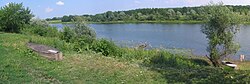 Seym in Kursk Oblast | |
| Location | |
| Country | Russia, Ukraine |
| Physical characteristics | |
| Source | |
| • location | Belgorod Oblast |
| Mouth | Desna |
• coordinates | 51°27′34″N 32°33′50″E / 51.45944°N 32.56389°ECoordinates: 51°27′34″N 32°33′50″E / 51.45944°N 32.56389°E |
| Length | 748 km (465 mi) |
| Basin size | 27,500 km2 (10,600 sq mi) |
| Discharge | |
| • average | 99.6 m³/s[1] |
| Basin features | |
| Progression | Desna→ Dnieper→ Dnieper–Bug estuary→ Black Sea |
| Tributaries | |
| • left | Reut, Vyr |
| • right | Tuskar, Svapa, Kleven |

The Seym (also transcribed as Seim and Sejm, in Russian: Сейм; Ukrainian: Сейм) is a west-flowing river in Russia and Ukraine. Its length is 748 kilometres (465 mi) (250 km within Ukraine) and its basin area about 27,500 square kilometres (10,600 sq mi). It is the largest tributary of the Desna.[2][3][1][4]
Places on the river are: Kursk, Kurchatov, Rylsk, Ukrainian border, Putyvl, Baturin, junction with the Desna which continues west and south past Chernihiv to Kyiv.
References[]
- ^ a b "Сейм (река)" (in Russian). Большая Советская Энциклопедия. Retrieved 2019-05-05.
- ^ Izsák Tibor (2007). Ukrajna természeti földrajza (pdf) (in Hungarian). II. Rákóczi Ferenc Kárpátaljai Magyar Főiskola. p. 95. Retrieved 2019-05-05.
- ^ "NÉVJEGYZÉK-SZÓTÁR az UKRAJNA TERMÉSZETI FÖLDRAJZA tantárgyhoz" (pdf) (in Hungarian). II. Rákóczi Ferenc Kárpátaljai Magyar Főiskola. Retrieved 2019-05-05.
- ^ "Seim River". Encyclopedia of Ukraine. Retrieved 2019-05-05.
This article related to a river in Russia is a stub. You can help Wikipedia by . |
This Belgorod Oblast location article is a stub. You can help Wikipedia by . |
This Kursk Oblast location article is a stub. You can help Wikipedia by . |
Categories:
- Tributaries of the Desna River
- Rivers of Belgorod Oblast
- Rivers of Kursk Oblast
- Rivers of Sumy Oblast
- Russia–Ukraine border
- Russia river stubs
- Belgorod Oblast geography stubs
- Kursk Oblast geography stubs
- Ukraine river stubs