Sheridan Township, Carroll County, Iowa
Sheridan Township, Carroll County | |
|---|---|
 | |
| Coordinates: 42°10′02″N 094°48′26″W / 42.16722°N 94.80722°WCoordinates: 42°10′02″N 094°48′26″W / 42.16722°N 94.80722°W | |
| Country | |
| State | |
| County | Carroll |
| Area | |
| • Total | 34.82 sq mi (90.19 km2) |
| • Land | 34.82 sq mi (90.17 km2) |
| • Water | 0 sq mi (0.01 km2) |
| Elevation | 1,220 ft (372 m) |
| Population (2000) | |
| • Total | 461 |
| • Density | 13.2/sq mi (5.1/km2) |
| FIPS code | 19-93840[2] |
| GNIS feature ID | 0468691 |

Sheridan Township is one of eighteen townships in Carroll County, Iowa, USA. As of the 2000 census, its population was 461.
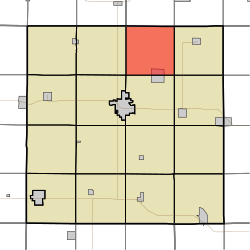
Geography[]
Sheridan Township covers an area of 34.82 square miles (90.2 km2) and contains one incorporated settlement, Lidderdale. According to the USGS, it contains two cemeteries: East Liberty and Immanuel.
References[]
- ^ "US Board on Geographic Names". United States Geological Survey. 2007-10-25. Retrieved 2008-01-31.
- ^ "U.S. Census website". United States Census Bureau. Retrieved 2008-01-31.
External links[]
Municipalities and communities of Carroll County, Iowa, United States | ||
|---|---|---|
| Cities | ||
| Townships | ||
| Unincorporated communities | ||
| Footnotes | ‡This populated place also has portions in an adjacent county or counties | |
| ||
This article about the geography of Carroll County, Iowa is a stub. You can help Wikipedia by . |
Categories:
- Townships in Carroll County, Iowa
- Townships in Iowa
- Northwest Iowa geography stubs