Siófok District
Siófok District
Siófoki járás | |
|---|---|
 Coat of arms | |
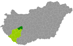 Siófok District within Hungary and Somogy County. | |
| Country | |
| Region | Southern Transdanubia |
| County | Somogy |
| District seat | Siófok |
| Area | |
| • Total | 657.05 km2 (253.69 sq mi) |
| Area rank | 4th in Somogy |
| Population (2011 census) | |
| • Total | 51,099 |
| • Rank | 2nd in Somogy |
| • Density | 78/km2 (200/sq mi) |
Siófok (Hungarian: Siófoki járás) is a district in north-eastern part of Somogy County. Siófok is also the name of the town where the district seat is found. The district is located in the Southern Transdanubia Statistical Region.
Geography[]
Siófok District borders with Balatonfüred District and Balatonalmádi District (Veszprém County) to the north, Enying District (Fejér County) to the east, Tamási District (Tolna County) to the southeast, Tab District to the south, Fonyód District to the west. The number of the inhabited places in Siófok District is 24.
Municipalities[]
The district has 3 towns, 1 large village and 20 villages. (ordered by population, as of 1 January 2013)[1]
- Ádánd (2,124)
- Balatonendréd (1,330)
- Balatonföldvár (2,235)
- Balatonőszöd (507)
- Balatonszabadi (2,994)
- Balatonszárszó (1,965)
- Balatonszemes (1,827)
- Balatonvilágos (1,195)
- Bálványos (544)
- Kereki (556)
- Kötcse (481)
- Kőröshegy (1,329)
- Nagyberény (1,330)
- Nagycsepely (386)
- Nyim (270)
- Pusztaszemes (343)
- Ságvár (1,830)
- Siófok (25,441) – district seat
- Siójut (620)
- Som (701)
- Szántód (592)
- Szólád (501)
- Teleki (209)
- Zamárdi (2,451)
The bolded municipalities are cities, italics municipality is large village.
See also[]
- List of cities and towns in Hungary
References[]
- ^ "A KSH 2013. évi helységnévkönyve". ksh.hu. Retrieved 2017-12-26.
External links[]
| Towns (3) |
| |
|---|---|---|
| Large village (1) | ||
| Villages (20) | ||
Coordinates: 46°54′20″N 18°02′42″E / 46.90550628902484°N 18.044952707640824°E

This Somogy county location article is a stub. You can help Wikipedia by . |
- Districts in Somogy County
- Somogy geography stubs