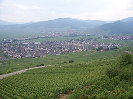
Sigolsheim
Sigolsheim | |
|---|---|
Part of Kaysersberg-Vignoble | |
 | |
 Coat of arms | |
show Location of Sigolsheim | |
 Sigolsheim | |
| Coordinates: 48°08′05″N 7°18′06″E / 48.1347°N 7.3017°ECoordinates: 48°08′05″N 7°18′06″E / 48.1347°N 7.3017°E | |
| Country | France |
| Region | Grand Est |
| Department | Haut-Rhin |
| Arrondissement | Colmar-Ribeauvillé |
| Canton | Sainte-Marie-aux-Mines |
| Commune | Kaysersberg-Vignoble |
| Area 1 | 5.8 km2 (2.2 sq mi) |
| Population (2017)[1] | 1,285 |
| • Density | 220/km2 (570/sq mi) |
| Time zone | UTC+01:00 (CET) |
| • Summer (DST) | UTC+02:00 (CEST) |
| Postal code | 68240 |
| Elevation | 188–401 m (617–1,316 ft) (avg. 194 m or 636 ft) |
| 1 French Land Register data, which excludes lakes, ponds, glaciers > 1 km2 (0.386 sq mi or 247 acres) and river estuaries. | |


Sigolsheim (French pronunciation: [siɡɔlsɛ̃]; Alsatian: Sìjelse) is a former commune in the Haut-Rhin department in north-eastern France. On 1 January 2016, it was merged into the new commune Kaysersberg-Vignoble.[2]
Children previously attended school in the École élémentaire publique intercommunale which had preschool (maternelle) and elementary.[3]
Population[]
| Year | Pop. | ±% |
|---|---|---|
| 2005 | 1,097 | — |
| 2006 | 1,177 | +7.3% |
| 2007 | 1,212 | +3.0% |
| 2008 | 1,199 | −1.1% |
| 2009 | 1,185 | −1.2% |
| 2010 | 1,172 | −1.1% |
| 2011 | 1,201 | +2.5% |
| 2012 | 1,183 | −1.5% |
| 2013 | 1,195 | +1.0% |
See also[]
References[]
- ^ Téléchargement du fichier d'ensemble des populations légales en 2017, INSEE
- ^ Arrêté 14 July 2015 (in French)
- ^ "École élémentaire publique intercommunale." French Ministry of Education. Retrieved on October 6, 2016.
| Wikimedia Commons has media related to Sigolsheim. |
| show Authority control |
|---|
This Haut-Rhin geographical article is a stub. You can help Wikipedia by . |
Categories:
- Former communes of Haut-Rhin
- Haut-Rhin geography stubs