Sirijap
| Sirijap | |
|---|---|
 | |
| Coordinates | 33°44′24″N 78°50′56″E / 33.74°N 78.849°ECoordinates: 33°44′24″N 78°50′56″E / 33.74°N 78.849°E |
| Elevation | 4,300 metres (14,108 ft) |


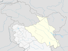
Sirijap is a small plain in the southern part of the Aksai Chin region which is controlled by China but claimed by India. It is on northern bank of the Pangong Tso.
India had established three posts in Sirijap prior to the Sino-Indian War in 1962. between April 1960 and October 1962. Chinese forces defeated these posts on 21 October 1962 after encountering fierce resistance.[1][2]
After the war, a Line of Actual Control (LAC) has come into being, which in India's view, runs to the left of the Sirijap plain at a shore point called "Finger 8". China claims the LAC to be further west at "Finger 4". The area between the two fingers continues to be patrolled by the Indian border police.
In May 2013, it was report that China had constructed a metal-top road in the area leading up to Finger 4. The Indian army claims to have used the road to patrol the area.[3]


See also[]
Notes[]
- ^ From map: "THE DELINEATION OF INTERNATIONAL BOUNDARIES ON THIS MAP MUST NOT BE CONSIDERED AUTHORITATIVE"
References[]
- ^ Singh, edited by Jasjit (15 March 2013). China's India War, 1962 : looking back to see the future. New Delhi: KW Publishers in association with Centre for Air Power Studies. ISBN 978-93-81904-72-5. Retrieved 2 October 2017.CS1 maint: extra text: authors list (link)
- ^ Thapliyal, SV (2005). "Battle of Eastern Ladakh : 1962 Sino-Indian Conflict". Journal of the United Service Institution of India. 135 (560): 282–298.
- ^ "China constructs 5 km road crossing LAC". The Hindu. 26 May 2013.
- Areas occupied by China through the Sino-Indian War
- Tibet
- Pangong Lake
- Borders of Ladakh