Sky Acres Airport
Coordinates: 41°42′27″N 073°44′17″W / 41.70750°N 73.73806°W

Sky Acres Airport | |||||||||||
|---|---|---|---|---|---|---|---|---|---|---|---|
| Summary | |||||||||||
| Airport type | Public | ||||||||||
| Owner | Sky Acres Enterprises, Inc. | ||||||||||
| Serves | Millbrook, New York | ||||||||||
| Elevation AMSL | 698 ft / 213 m | ||||||||||
| Map | |||||||||||
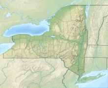 44N Location of airport in New York / United States | |||||||||||
| Runways | |||||||||||
| |||||||||||
| Statistics (2005) | |||||||||||
| |||||||||||

Sky Acres Airport (FAA LID: 44N) is a public-use airport located six miles (10 km) southwest of the central business district of Millbrook, a village in Dutchess County, New York, United States. It is privately owned by Sky Acres Enterprises, Inc.[1]
Facilities and aircraft[]
Sky Acres Airport covers an area of 205 acres (83 ha) and contains one runway designated 17/35 with a 3,830 x 60 ft (1,167 x 18 m) asphalt pavement. For the 12-month period ending September 15, 2005, the airport had 48,300 aircraft operations, an average of 132 per day: 99% general aviation and 1% military. There are 95 aircraft based at this airport: 82% single-engine and 18% multi-engine.[1]
Accidents[]
On August 17, 2019, a Cessna 303 plane that was descending into the airport crashed into a private home resulting in the death of the pilot, Francisco Knipping Diaz, a Dominican American attorney from Manhattan and local homeowner Gerard "Jerry" Bocker.[2]
References[]
- ^ a b c FAA Airport Form 5010 for 44N PDF, effective 2007-12-20
- ^ Photos show wreckage of deadly plane crash near Poughkeepsie from The New York Post 18 August 2019
External links[]
- Resources for this airport:
- FAA airport information for 44N
- AirNav airport information for 44N
- FlightAware airport information and live flight tracker
- SkyVector aeronautical chart for 44N
This article about an airport in New York is a stub. You can help Wikipedia by . |
- Airports in New York (state)
- Transportation buildings and structures in Dutchess County, New York
- Northeastern United States airport stubs
- New York (state) building and structure stubs
- New York (state) transportation stubs