Slack (river)
show This article may be expanded with text translated from the corresponding article in French. (January 2021) Click [show] for important translation instructions. |
| Slack | |
|---|---|
 The Slack | |
| Native name | La Slack (French) |
| Location | |
| Country | France |
| Physical characteristics | |
| Source | |
| • location | Pas-de-Calais |
| Mouth | |
• location | English Channel |
• coordinates | 50°48′18″N 1°36′5″E / 50.80500°N 1.60139°ECoordinates: 50°48′18″N 1°36′5″E / 50.80500°N 1.60139°E |
| Length | 22 km (14 mi) |

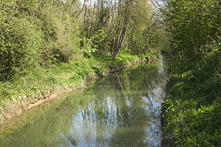
The Slack (French pronunciation: [slak], in Picard locally [s̟laːk]) is a 22-kilometre-long (14 mi) coastal river in the Pas-de-Calais department, in northern France.[1]
It rises at Hermelinghen on , flows through Rinxent, Marquise, Beuvrequen, Slack (village near Ambleteuse) and flows into the English Channel in Ambleteuse next to Fort Mahon.

The Slack and Fort Mahon
References[]
External links[]
| Wikimedia Commons has media related to Slack River. |
| show Authority control |
|---|
Categories:
- Rivers of the Pas-de-Calais
- Rivers of France
- Rivers of Hauts-de-France
- Coastal basins of the English Channel in France
- France river stubs