Smyha
Smyha
Смига | |
|---|---|
 Smyha Location of Smyha in Ukraine | |
| Coordinates: 50°14′24″N 25°45′57″E / 50.24000°N 25.76583°ECoordinates: 50°14′24″N 25°45′57″E / 50.24000°N 25.76583°E | |
| Country | |
| Province | |
| District | |
| Founded | 1861 |
| Town status | 1980 |
| Government | |
| • Town Head | Mykola Pakhalyuk |
| Area | |
| • Total | 34.17 km2 (13.19 sq mi) |
| Elevation | 224 m (735 ft) |
| Population (2001) | |
| • Total | 3,015 |
| • Density | 88/km2 (230/sq mi) |
| Time zone | UTC+2 (EET) |
| • Summer (DST) | UTC+3 (EEST) |
| Postal code | 35680 |
| Area code | +380 3656 |
| Website | http://rada.gov.ua/ |

Smyha (Ukrainian: Смига) is an urban-type settlement in Dubno Raion (district) of Rivne Oblast (province) in western Ukraine. Its population is 3,015 as of the 2001 Ukrainian Census.[2] Current population: 2,597 (2021 est.)[3]
The settlement was first founded in 1861 as the village of Kenneberg (Ukrainian: Кеннеберг).[2] It was renamed to its current name "Smyha" in 1928, and it acquired the status of an urban-type settlement in 1980.[2]
Images[]
Church, 1991

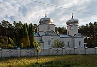
Church, 2013


References[]
- ^ "Smyha (Rivne Oblast, Dubno Raion)". weather.in.ua. Retrieved 9 February 2012.
- ^ a b c "Smyha, Rivne Oblast, Dubno Raion". Regions of Ukraine and their Structure (in Ukrainian). Verkhovna Rada of Ukraine. Retrieved 9 February 2012.[permanent dead link]
- ^ "Чисельність наявного населення України (Actual population of Ukraine)" (PDF) (in Ukrainian). State Statistics Service of Ukraine. Retrieved 11 July 2021.
This article about a location in Rivne Oblast is a stub. You can help Wikipedia by . |
Categories:
- Urban-type settlements in Rivne Oblast
- Populated places established in 1861
- 1861 establishments in the Russian Empire
- Ukraine geography stubs