Snyder Lake
| Snyder Lake | |
|---|---|
 A view of the lake from the campground shortly after sunrise | |
 Snyder Lake | |
| Location | Glacier National Park, Flathead County, Montana, US |
| Coordinates | 48°37′38″N 113°48′09″W / 48.62722°N 113.80250°WCoordinates: 48°37′38″N 113°48′09″W / 48.62722°N 113.80250°W[1] |
| Type | Natural |
| Primary outflows | Snyder Creek |
| Basin countries | United States |
| Max. length | .15 mi (0.24 km) |
| Max. width | .08 mi (0.13 km) |
| Surface elevation | 5,246 ft (1,599 m) |


Snyder Lake is located in Glacier National Park, in the U. S. state of Montana. Snyder Lake is south-southwest of Upper Snyder Lake.[2]
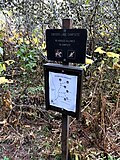
A sign at the Snyder Lake campground

See also[]
- List of lakes in Flathead County, Montana (M-Z)
References[]
- ^ "Snyder Lake". Geographic Names Information System. United States Geological Survey. Retrieved 2011-02-20.
- ^ "Mount Cannon, MT" (Map (USGS Quad)). TopoQuest. Retrieved 2011-02-20.
This Flathead County, Montana state location article is a stub. You can help Wikipedia by . |
Categories:
- Lakes of Glacier National Park (U.S.)
- Lakes of Flathead County, Montana
- Flathead County, Montana geography stubs