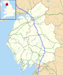
Solway Moss
This article needs additional citations for verification. (February 2021) |
| Solway Moss | |
|---|---|
 | |
| Location | Cumbria, England |
| Coordinates | 55°00′40″N 3°01′33″W / 55.011225°N 3.025749°WCoordinates: 55°00′40″N 3°01′33″W / 55.011225°N 3.025749°W |
Solway Moss, also known as Solway Flow, is a moss (lowland peat bog), in the City of Carlisle in Cumbria, England near the Scottish border and less than 1 mile (1.6 km) west of Longtown at grid reference NY345690. As of 2005, the moss is the subject of a campaign by organisations including the RSPB and Friends of the Earth to get the area declared a Special Area of Conservation in order to prevent the destruction of the rare raised bog ecology [1].
In 1542 it was the location of the Battle of Solway Moss.
On 16 November 1771, during the night, Solway Moss burst, flooding local farms and settlements.[1] one of several rivers to do so in the Great Flood of 1771.
References[]
- ^ McEwen, Lindsey J.; Withers, Charles W. J. (1989). "Historical records and geomorphological events: the 1771 'eruption' of Solway Moss". Scottish Geographical Magazine. 105 (3): 149–157. doi:10.1080/14702548908554428.
Categories:
- Landforms of Cumbria
- Bogs of England
- Cumbria geography stubs
