South Coast Metro


The South Coast Metro is a district in Orange County, California within the cities of Santa Ana and Costa Mesa. The area is a dense mix of residential, office, and retail developments that spreads out from the South Coast Plaza mall. It forms part of the South Coast Plaza–John Wayne Airport edge city, a concentration of business, shopping, and entertainment outside a traditional central business district. The edge city's area is defined to include John Wayne Airport, the Irvine Business Complex (IBC), The District and The Market Place shopping centers, and the University of California, Irvine campus.[1] This larger definition extends into Newport Beach, Irvine, and Tustin.
South Coast Metro[]
South Coast Metro straddles the city limits of Santa Ana and Costa Mesa, and is a dense mix of residential, office, and retail developments that spreads out from South Coast Plaza and forms an urban-retail village that is distinct from the surrounding suburban development.[2] The cultural element includes the Segerstrom Center for the Arts and South Coast Repertory theater company.[3][4][5]
History[]
C. J. Segerstrom and Sons, a commercial real estate and retail management organization established in 1898, spearheaded commercial development in Orange County, California. Henry Segerstrom, as managing partner of the family-owned company, transformed the agricultural area into a lively, international destination. In March 1967, Henry T. Segerstrom, along with his cousin Hal T. Segerstrom, Jr., opened a shopping center called South Coast Plaza in one of the family's lima bean fields in rapidly growing Orange County.[6] Two high-rise residential towers, dubbed Skyline at Macarthur Place, were built in 2016 in the northeast corner of South Coast Metro by developer Skyline OC. The 25-story towers were marketed as high-end luxury condominiums, and became the tallest buildings in Orange County by number of floors.[citation needed]
Geography[]
South Coast Metro's boundaries are generally defined as:
- North: Segerstrom Avenue
- South: San Diego Freeway (I-405)
- West: Fairview Road
- East: Costa Mesa Freeway (SR 55)
Used often in real estate listings, the South Coast Metro moniker is not recognized by the USPS or other government entities as a distinct region. While there is no separate ZIP code for South Coast Metro, a freeway sign for the area is on the southbound Costa Mesa Freeway at MacArthur Boulevard.
Business and retail[]
The South Coast Metro area includes its namesake, South Coast Plaza, along with approximately twenty high-rise office buildings, hotels and residences.[7] This includes the 21-story Center Tower, the tallest building in Orange County at 285 feet.[8] The area also includes additional retail shopping, entertainment, and several upscale restaurants. Banc of California relocated its headquarters to South Coast Metro, at 3 MacArthur Place in Santa Ana, in 2016.[9][10] Yokohama Tire Corporation's United States headquarters are also located in South Coast Metro, at 1 MacArthur Place, Santa Ana.
Arts district[]
The area around the Segerstrom Center for the Arts is called the Costa Mesa Theater and Arts District. The South Coast Repertory building was expanded and renovated in 2002, with the design done by architect César Pelli. Pelli also designed the Plaza Tower, opened in 1992, and the Renee and Henry Segerstrom Concert Hall, which opened in 2006. Several prominent outdoor sculptures and other works of arts are displayed in the area around these buildings by artists such as Isamu Noguchi, Jean Dubuffet, Henry Moore, Richard Serra and others.[11] A satellite of the Orange County Museum of Art, called The Orange Lounge, is located inside South Coast Plaza. Recently, plans have been drawn to move the main museum, currently located in Newport Beach, into the portion of the Theater and Arts District set aside for the institution.
Freeway Triangle[]
The proximity of the San Diego (I-405), Costa Mesa (SR 55), and Corona Del Mar (SR 73) freeways creates an isolated triangular area that totals about 0.6 square miles (1.6 km2) of land. Excluding freeway ramps, the area has limited points of entry and exit:
- Bear Street travels over I-405 and under SR 73
- Bristol Street travels over I-405 and under SR 73
- Baker Street travels under SR 73 and under SR 55
- Paularino Avenue travels under SR 55
The triangular area is densely populated and home to points of interest such as The LAB Anti-Mall and Trinity Christian Center International.
Irvine Business Complex[]


The Irvine Business Complex (IBC) consists of the area roughly bounded by MacArthur Boulevard, Barranca Parkway, Campus Drive, and Jamboree Road. It was already defined in the 1970s in the master plan of the City of Irvine as an area designated as a commercial and industrial center, one that would be an economic and employment base for all of Southern California, including hotel, restaurant, commercial, retail, industrial, and office uses.[12] After 2004, the plan changed several times and the City envisioned mixed-use development in a new urban area built within the IBC, incorporating up to 15,000 residential units among the businesses, and a more pedestrian- and bike-friendly, denser street grid.[13]
Other components of the edge city[]

The University of California, Irvine, campus lies roughly a mile southeast of the IBC across the San Joaquin Wildlife Sanctuary.
The edge city development continues northeast, where the million-square-foot shopping center known as "The District" lies immediately adjacent to the Irvine Business Complex. It is part of the planned community of Tustin Legacy. Business parks continue for three miles northeast of The District, to the even larger, 165-acre Market Place shopping and entertainment complex.
Other nearby edge cities[]
About 2.5 miles to the south of UCI is Newport Center, itself defined as an edge city, within the city of Newport Beach. About seven miles east is the Irvine Spectrum edge city, mostly within the city of Irvine but spilling into Laguna Hills.
Transportation[]
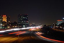
The edge city is served by the San Diego (I-405), Costa Mesa (SR-55), and San Joaquin Hills (SR-73) freeways. During rush hour, the 405-55 interchange becomes one of the most congested in the United States, with an average daily traffic volume of 433,000 cars.[14] The congestion has worsened in recent years despite an upgrade completed in 2005 which included the addition of carpool lane connectors.
OCTA (the Orange County Transportation Authority) and U.C. Irvine's Anteater Express provide public bus service. South Coast Plaza is currently the most-served location in Orange County, connected by 12 bus routes.[15] The edge city was to be served by the cancelled CenterLine light rail project, including an underground station at South Coast Plaza.[16]
References[]
- ^ Garreau, Joel (1991). Edge City. Retrieved 24 June 2019.
- ^ Gewerz, Catherine (September 30, 1991). "County Losing the 'Sub' from Suburb : Trend: The author of a new book says several areas of O.C. have evolved from bedroom communities into urban centers called 'Edge Cities.'". Los Angeles Times. Retrieved June 25, 2019.
- ^ Boehm, Mike (January 13, 2011). "The Orange County Performing Arts Center is changing names". Los Angeles Times. Retrieved 27 June 2016.
- ^ Giuliano, Genevieve, & Kenneth A. Small (1991). Subcenters in the Los Angeles region. Regional Science and Urban Economics, 21: 163-182 (p.170).
- ^ Zint, Bradley (November 23, 2014). "Costa Mesa will continue urbanization with luxury apartment complex". Los Angeles Times. Retrieved 26 June 2016.
- ^ Hughes, Paul (February 20, 2015). "Henry Segerstrom Passes". Orange County Business Journal. Retrieved 29 June 2016.
- ^ Money, Luke (March 1, 2019). "Costa Mesa council to screen project that would add 1,057 residential units, office and retail space north of 405". Los Angeles Times. Retrieved 2 March 2019.
- ^ "http://www.ocalmanac.com/Structures/st01.htm" OC Almanac
- ^ "Banc of California to Purchase New Corporate Headquarters". Business Wire. Retrieved September 12, 2016.
- ^ "What it Means to be California's Bank". LA Progressive. Retrieved September 12, 2016.
- ^ Boehm, Mike (November 30, 2011). "Henry Segerstrom's mall hosts exhibit on his public art patronage". Los Angeles Times. Retrieved 27 June 2016.
- ^ TAXIN, AMY; TULLY, SARAH; ROWE, JEFF (March 19, 2006). "Urban centers of attention". Orange County Register. Retrieved June 29, 2019.
- ^ "Irvine Business Complex", City of Irvine Master Plan
- ^ Ignatin, Heather Lourie (May 5, 2005). "405/55 car-pool lanes get hookup". The Orange County Register. Archived from the original on March 30, 2008.
- ^ Money, Luke (July 14, 2017). "Officials celebrate Costa Mesa Line shuttle bus". Daily Pilot. Retrieved 15 July 2017 – via LA Times.
- ^ Reyes, David (October 15, 2005). "Rail's Loss, Cities' Gain". Los Angeles Times. Retrieved 19 December 2015.
Coordinates: 33°42′0″N 117°53′0″W / 33.70000°N 117.88333°W

- Geography of Orange County, California
- Edge cities in Greater Los Angeles
- Neighborhoods of Santa Ana, California