South Sweden
This article needs additional citations for verification. (June 2020) |
South Sweden
Sydsverige | |
|---|---|
National Area | |
 | |
| Country | |
| Largest city | |
| Area | |
| • Total | 13,968 km2 (5,393 sq mi) |
| Population | |
| • Total | 1,306,695 |
| • Density | 94/km2 (240/sq mi) |
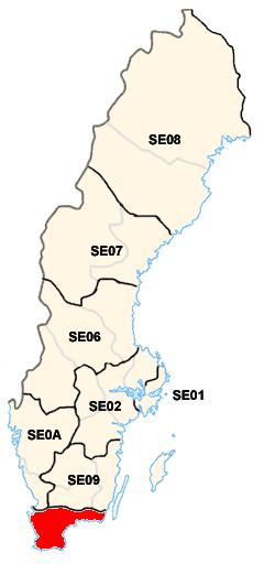
| ISO 3166 code | SE04 |
South Sweden (Swedish: Sydsverige) is a National Area (Swedish: Riksområde) of Sweden. The National Areas are a part of the Nomenclature of Territorial Units for Statistics (NUTS) of Sweden.
Geography[]
South Sweden is situated in the southern part of its country. It is close to Denmark and it borders with the riksområden of Småland and the islands and West Sweden.
The most populous cities are Malmö, Helsingborg, Lund, Karlskrona, Kristianstad, Landskrona and Trelleborg.
Subdivision[]
South Sweden includes 2 counties:
 Blekinge (seat: Karlskrona)
 Skåne (seat: Malmö)
Economy[]
The Gross domestic product (GDP) of the region was 59.6 billion € in 2018, accounting for 12.6% of Swedish economic output. GDP per capita adjusted for purchasing power was 31,100 € or 103% of the EU27 average in the same year. The GDP per employee was also 103% of the EU average.[1]
See also[]
- Greater Malmö
- Götaland
- NUTS statistical regions of Sweden
- ISO 3166-2:SE
- Administrative divisions of Sweden
References[]
External links[]
![]() Media related to National Areas of Sweden at Wikimedia Commons
Media related to National Areas of Sweden at Wikimedia Commons
National Areas (Riksområden) of Sweden | |||
|---|---|---|---|
| |||

- South Sweden
- National Areas of Sweden
- Götaland
- NUTS 2 statistical regions of the European Union