Sovietske
Sovietske
Совєтське | |
|---|---|
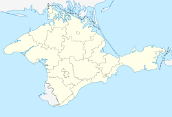 Sovietske Location of Sovietske in Crimea | |
| Coordinates: 44°31′53″N 34°11′17″E / 44.53139°N 34.18806°ECoordinates: 44°31′53″N 34°11′17″E / 44.53139°N 34.18806°E | |
| Country | Disputed between Russia and Ukraine[1] |
| Republic | Crimea |
| Municipality | Yalta Municipality |
| Founded | 1929 |
| Town status | 1971 |
| Area | |
| • Total | 0.326 km2 (0.126 sq mi) |
| Elevation | 458 m (1,503 ft) |
| Population (2014) | |
| • Total | 670 |
| • Density | 2,100/km2 (5,300/sq mi) |
| Time zone | UTC+4 (MSK) |
| Postal code | 98653 |
| Area code | +380 654 |
| Website | http://rada.gov.ua/ |

Sovietske (Ukrainian: Совєтське; Russian: Советское; Crimean Tatar: Dolossı) is an urban-type settlement in the Yalta Municipality of the Autonomous Republic of Crimea, a territory recognized by a majority of countries as part of Ukraine and annexed by Russia as the Republic of Crimea.[3]
The settlement was first founded in 1929 after the creation of the "Dolossi" resort hotel. Sovietske is located on Crimea's southern shore at an elevation of 458 metres (1,503 ft).[2] It is administratively subordinate to the Massandra Settlement Council.[3] Its population was 511 in the 2001 Ukrainian census.[3] Current population: 670 (2014 Census).[4]
References[]
- ^ This place is located on the Crimean peninsula, most of which is the subject of a territorial dispute between Russia, which administers the contested area, and Ukraine, whose internationally recognised boundaries include the contested area. According to the political division of Russia, there are federal subjects of the Russian Federation (the Republic of Crimea and the federal city of Sevastopol) located on the peninsula. According to the administrative-territorial division of Ukraine, there are the Ukrainian divisions (the Autonomous Republic of Crimea and the city with special status of Sevastopol) located on the peninsula.
- ^ a b "Sovietske (Crimea region)". weather.in.ua. Retrieved 29 July 2014.
- ^ a b c "Sovietske, Autonomous Republic of Crimea, City of Yalta". Regions of Ukraine and their Structure (in Ukrainian). Verkhovna Rada of Ukraine. Retrieved 29 July 2014.
- ^ Russian Federal State Statistics Service (2014). "Таблица 1.3. Численность населения Крымского федерального округа, городских округов, муниципальных районов, городских и сельских поселений" [Table 1.3. Population of Crimean Federal District, Its Urban Okrugs, Municipal Districts, Urban and Rural Settlements]. Федеральное статистическое наблюдение «Перепись населения в Крымском федеральном округе». ("Population Census in Crimean Federal District" Federal Statistical Examination) (in Russian). Federal State Statistics Service. Retrieved January 4, 2016.
| Cities | ||
|---|---|---|
| Settlements | ||
| Villages | ||
This article about a location in Crimea is a stub. You can help Wikipedia by . |
Categories:
- Urban-type settlements in Crimea
- Seaside resorts in Russia
- Seaside resorts in Ukraine
- Yalta Municipality
- Populated places established in 1929
- Crimea geography stubs