Spodnji Okrog
Spodnji Okrog
Kozji Hrbet | |
|---|---|
 | |
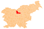
 Spodnji Okrog Location in Slovenia | |
| Coordinates: 46°13′23″N 14°50′11″E / 46.22306°N 14.83639°ECoordinates: 46°13′23″N 14°50′11″E / 46.22306°N 14.83639°E | |
| Country | |
| Traditional region | Upper Carniola |
| Statistical region | Central Slovenia |
| Municipality | Kamnik |
| Elevation | 700 m (2,300 ft) |

Spodnji Okrog (pronounced [ˈspoːdnji ɔˈkɾoːk]) is a former settlement in the Municipality of Kamnik in central Slovenia. It is now part of the village of Okrog pri Motniku.[1] The area is part of the traditional region of Upper Carniola. The municipality is now included in the Central Slovenia Statistical Region.
Geography[]
Spodnji Okrog lies below the southern slope of Deer Peak (Jelen vrh, elevation: 850 meters or 2,790 feet), about 800 meters (2,600 ft) north of the main road through Špitalič in the valley of Motnišnica Creek.
Name[]
Spodnji Okrog was attested as Puxruk in 1261, Pokkesrukke in 1265, Poxrugkh in 1307, Bukzrukk in 1329, and Puochsruck in 1488.[2] Before the Second World War, the village was known as Kozji Hrbet (in older sources also Kozji herbt;[3] literally, 'goat back').[1][4][5] The name Spodnji Okrog means 'lower Okrog' and contrasts with Zgornji Okrog (literally 'upper Okrog'), which lies about 540 meters (1,770 ft) to the north-northwest. Together with the related name Krog, the name Okrog is relatively common in Slovenia. It is derived from the common noun krog 'rounded hill', referring to the local topography.[6]
History[]
In the past, the trade route between the Tuhinj Valley and Špitalič passed through Spodnji Okrog. In 1952, the three former villages of , Spodnji Okrog, and Zgornji Okrog were combined into a single village named Spodnji Okrog.[7] In 1955, the name of the newly combined settlement was changed from Spodnji Okrog to Okrog pri Motniku.[7][8]
Cultural heritage[]

There is a chapel-shrine in Spodnji Okrog known as the Mošnik shrine (Slovene: Mošnikova kapelica). It stands in the southern part of the settlement and dates from 1903.[9]
References[]
- ^ a b Savnik, Roman (1971). Krajevni leksikon Slovenije, vol. 2. Ljubljana: Državna založba Slovenije. p. 191.
- ^ Mlinarič, Jože (1981). "Posest vetrinjskega samostana na Kranjskem (od leta 1147 do XVII. stoletja)". Zgodovinski časopis. 35 (1–2): 114–116.
- ^ Special-Orts-Repertorium von Krain. Vienna: Alfred Hölder. 1884. p. 138.
- ^ Krajevni leksikon Dravske Banovine. 1937. Ljubljana: Zveza za tujski promet za Slovenijo, p. 200.
- ^ Klobčar, Marija (2016). Na poti v Kamnik. Ljubljana: Založba ZRC. p. 22.
- ^ Snoj, Marko (2009). Etimološki slovar slovenskih zemljepisnih imen. Ljubljana: Modrijan. p. 217.
- ^ a b Marinković, Dragan (1991). Abecedni spisak naselja u SFRJ. Promene u sastavu i nazivima naselja za period 1948–1990. Belgrade: Savezni zavod za statistiku. pp. 71, 75, 95, 120.
- ^ Spremembe naselij 1948–95. 1996. Database. Ljubljana: Geografski inštitut ZRC SAZU, DZS.
- ^ "Spodnji Okrog pri Motniku - Kapelica". Register kulturne dediščine. Ministrstvo za kulturo. Retrieved January 16, 2021.
External links[]
 Media related to Spodnji Okrog at Wikimedia Commons
- Spodnji Okrog on Geopedia
- Populated places in the Municipality of Kamnik
- Former settlements in Slovenia
- Kamnik geography stubs