Springfield–Beckley Municipal Airport
Coordinates: 39°50′25″N 083°50′25″W / 39.84028°N 83.84028°W

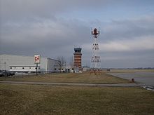
Springfield–Beckley Municipal Airport | |||||||||||||||
|---|---|---|---|---|---|---|---|---|---|---|---|---|---|---|---|
 | |||||||||||||||
| Summary | |||||||||||||||
| Airport type | Public | ||||||||||||||
| Owner | City of Springfield | ||||||||||||||
| Serves | Springfield, Ohio | ||||||||||||||
| Location | Green Township, Clark County, near Springfield, Ohio | ||||||||||||||
| Elevation AMSL | 1,051 ft / 320 m | ||||||||||||||
| Website | www.airparkohio.com/... | ||||||||||||||
| Map | |||||||||||||||
 SGH | |||||||||||||||
| Runways | |||||||||||||||
| |||||||||||||||
| Statistics (2005) | |||||||||||||||
| |||||||||||||||

Springfield–Beckley Municipal Airport (IATA: SGH, ICAO: KSGH, FAA LID: SGH) is a civil-military airport five miles (8 km) south of Springfield, in Clark County, Ohio. It is owned by the city of Springfield.[1] Named after the Beckley family, a member of which knew the Wright Brothers, and witnessed and photographed their first flights.
Three units of the Ohio Air National Guard, including the 178th Wing (formerly 178th Fighter Wing) are based at the co-located Springfield Air National Guard Base.
Springfield had scheduled airline flights, on TWA in 1948-50 and on Lake Central in 1953-55.
Facilities[]
The airport covers 1,516 acres (614 ha) and has two runways:[1]
- 6/24: 9,009 x 150 ft (2,746 x 46 m) Asphalt/Concrete
- 15/33: 5,499 x 100 ft (1,676 x 30 m) Asphalt
In the year ending November 29, 2005 the airport had 62,000 aircraft operations, average 169 per day: 75% general aviation, 21% military and 4% air taxi. 81 aircraft are based at this airport: 59% single-engine, 14% multi-engine, 1% jet, 1% ultralight and 25% military.[1]
References[]
- ^ a b c d FAA Airport Form 5010 for SGH PDF, effective 2007-10-25
External links[]
- Springfield–Beckley Municipal Airport
- Springfield Air National Guard Base (official site)
- Springfield Air National Guard Base (GlobalSecurity.org)
- FAA Airport Diagram (PDF), effective December 30, 2021
- Resources for this airport:
- FAA airport information for SGH
- AirNav airport information for KSGH
- ASN accident history for SGH
- FlightAware airport information and live flight tracker
- NOAA/NWS weather observations: current, past three days
- SkyVector aeronautical chart, Terminal Procedures
This article about an airport in Ohio is a stub. You can help Wikipedia by . |
- Airports in Ohio
- Buildings and structures in Clark County, Ohio
- Transportation in Clark County, Ohio
- Midwestern United States airport stubs
- Ohio building and structure stubs
- Ohio transportation stubs