Spur Point
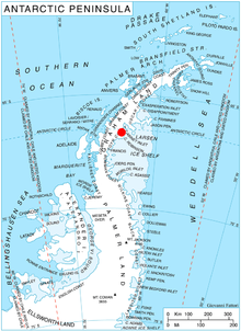
Spur Point (66°36′S 63°48′W / 66.600°S 63.800°WCoordinates: 66°36′S 63°48′W / 66.600°S 63.800°W) is a point at the east end of Bigla Ridge, a black, rocky spur which extends southeast between Sleipnir Glacier and Beaglehole Glacier to the west side of Cabinet Inlet, forming the southeast extremity of Heros Peninsula on the east coast of Graham Land. This descriptive name was given by the Falkland Islands Dependencies Survey (FIDS) following their survey in 1947. The feature was photographed from the air during 1947 by the Ronne Antarctic Research Expedition (RARE) under Ronne.
 WikiMiniAtlas
![]() This article incorporates public domain material from the United States Geological Survey document: "Spur Point". (content from the Geographic Names Information System)
This article incorporates public domain material from the United States Geological Survey document: "Spur Point". (content from the Geographic Names Information System) ![]()
This Foyn Coast location article is a stub. You can help Wikipedia by . |
- Headlands of Graham Land
- Foyn Coast
- Foyn Coast geography stubs