St. Brides-super-Ely
| St. Brides-super-Ely | |
|---|---|
 | |
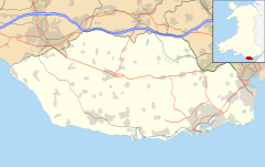 St. Brides-super-Ely Location within the Vale of Glamorgan | |
| OS grid reference | ST 0969 7773 |
| Community | |
| Principal area | |
| Country | Wales |
| Sovereign state | United Kingdom |
| Post town | Cowbridge |
| Postcode district | CF71 |
| Dialling code | 01446 |
| Police | South Wales |
| Fire | South Wales |
| Ambulance | Welsh |
| UK Parliament | |

St. Brides-super-Ely is a village and district of the community of Peterston-super-Ely, within the Vale of Glamorgan, South Wales. It is located near the western border of the Welsh Capital City of Cardiff, to the west of the A4232, and north of the River Ely.
The medieval Church of St Ffraid at St. Brides is Grade II listed.[1] An ancient yew tree stands in the churchyard near the south porch. It is 24 ft in diameter at its lower crown.[2]
The Grade II listed house St-y-Nyll stands just outside the village. It was designed by Percy Thomas and built in 1924.[3]
References[]
- ^ "Cof Cymru – National Historic Assets of Wales – Full Report for Listed Buildings – Church of St Ffraid". Cadw – Cof Cymru.
- ^ "Yew/Yews at St Brides - super - Ely Wales". Ancient Yews. Retrieved 7 January 2020.
- ^ "Cof Cymru – National Historic Assets of Wales – Full Report for Listed Buildings – St-y-Nyll". Cadw – Cof Cymru. Archived from the original on 7 January 2021.
| Wikimedia Commons has media related to St Bride's-super-Ely. |

This article about a location in Wales is a stub. You can help Wikipedia by . |
Categories:
- Villages in the Vale of Glamorgan
- Wales geography stubs