St. Luzisteig Pass
| St. Luzisteig Pass | |
|---|---|
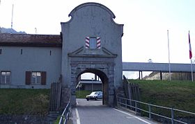 Entrance to the St. Luzisteig fortifications | |
| Elevation | 713 m (2,339 ft) |
| Location | Switzerland |
| Range | Alps |
| Coordinates | 47°2′17″N 9°31′38″E / 47.03806°N 9.52722°ECoordinates: 47°2′17″N 9°31′38″E / 47.03806°N 9.52722°E |

St. Luzisteig Pass (el. 713 m.) is a mountain pass in the Alps between the canton of Graubünden in Switzerland and Liechtenstein.
It connects Maienfeld in Graubünden and Balzers in Liechtenstein. Near the pass is a fortification that dates from the 18th century and is still used as a caserne by the Swiss Army.
The pass road has a maximum grade of 12 percent.
See also[]
- List of highest paved roads in Europe
- List of mountain passes
| hide Authority control | |
|---|---|
| General | |
| Other | |
This Graubünden location article is a stub. You can help Wikipedia by . |
This Liechtenstein location article is a stub. You can help Wikipedia by . |
Categories:
- Mountain passes of Switzerland
- Mountain passes of the Alps
- Mountain passes of Graubünden
- Graubünden geography stubs
- Liechtenstein geography stubs