Stankovany
Stankovany | |
|---|---|
Village | |
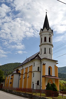 Church | |
 Stankovany Location of Stankovany in the Žilina Region | |
| Coordinates: 49°09′N 19°11′E / 49.150°N 19.183°ECoordinates: 49°09′N 19°11′E / 49.150°N 19.183°E | |
| Country | Slovakia |
| Region | Žilina |
| District | Ružomberok |
| First mentioned | 1322 |
| Area | |
| • Total | 12.797 km2 (4.941 sq mi) |
| Elevation | 649 m (2,129 ft) |
| Population | |
| • Total | 770 |
| • Density | 60/km2 (160/sq mi) |
| Postal code | 034 92 |
| Area code(s) | +421-44 |
| Car plate | RK |
| Website | www.stankovany.sk/ |


Stankovany is a village and municipality in Ružomberok District in the Žilina Region of northern Slovakia.
History[]
In historical records the village was first mentioned in 1322.
Geography[]
The municipality lies at an altitude of 649 metres (2,129 ft) and covers an area of 12.797 km2 (4.941 sq mi). It has a population of about 770 people.
External links[]
Municipalities of Ružomberok District | ||
|---|---|---|
Categories:
- Villages and municipalities in Ružomberok District