Steinbach am Wald
Steinbach a.Wald | |
|---|---|
 Coat of arms | |
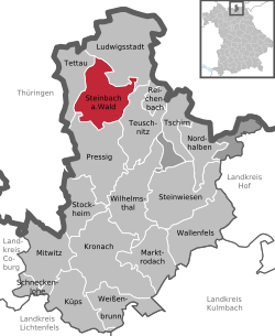
show Location of Steinbach a.Wald within Kronach district | |
 Steinbach a.Wald | |
| Coordinates: 50°25′57″N 11°21′39″E / 50.43250°N 11.36083°ECoordinates: 50°25′57″N 11°21′39″E / 50.43250°N 11.36083°E | |
| Country | Germany |
| State | Bavaria |
| Admin. region | Oberfranken |
| District | Kronach |
| Subdivisions | 9 Ortsteile |
| Government | |
| • Mayor (2017–23) | Thomas Löffler[1] (CSU) |
| Area | |
| • Total | 35.47 km2 (13.70 sq mi) |
| Elevation | 584 m (1,916 ft) |
| Population (2020-12-31)[2] | |
| • Total | 3,024 |
| • Density | 85/km2 (220/sq mi) |
| Time zone | UTC+01:00 (CET) |
| • Summer (DST) | UTC+02:00 (CEST) |
| Postal codes | 96361 |
| Dialling codes | 09263, 09268, 09269 |
| Vehicle registration | KC |
| Website | www.steinbach-am-wald.de |


Steinbach is a municipality in the district of Kronach in Bavaria in Germany.
History[]
The village was first mentioned in 1190. Until 1388 it was part of 'Eygen Teuschnitz', a large estate of Langheim monastery.
Economy[]
Biggest employer is Wiegand-Glas with branches in Großbreitenbach, Slovakia and South Africa.
Events[]
Every July, an association called "Zechgemeinschaft" celebrates the traditional fair. Unmarried young people dress themselves with the traditional clothes of the village and invite their guests to dance with them to typical music. In August, the rifle club's festival takes place.
References[]
- ^ Liste der ersten Bürgermeister/Oberbürgermeister in kreisangehörigen Gemeinden, Bayerisches Landesamt für Statistik, accessed 19 July 2021.
- ^ "Tabellenblatt "Daten 2", Statistischer Bericht A1200C 202041 Einwohnerzahlen der Gemeinden, Kreise und Regierungsbezirke". Bayerisches Landesamt für Statistik (in German). June 2021.
External links[]
- Official website (in German)
| show Authority control |
|---|
| show Towns and municipalities in Kronach (district) |
|---|
This Kronach district location article is a stub. You can help Wikipedia by . |
Categories:
- Municipalities in Bavaria
- Kronach (district)
- Upper Franconia geography stubs