Stephenson Glacier
| Stephenson Glacier | |
|---|---|
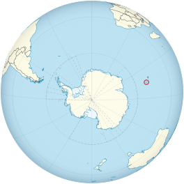 Location of Heard Island and McDonald Islands on the globe | |
| Type | cirque/tidewater |
| Location | Heard Island Territory of Heard Island and McDonald Islands Australia |
| Coordinates | 53°6′S 73°42′E / 53.100°S 73.700°E |
| Thickness | approximately 55 m |
| Terminus | between Dovers Moraine and |
| Status | Retreating[1][2][3][4][5] |

Stephenson Glacier (53°6′S 73°42′E / 53.100°S 73.700°E) is a glacier close west of Dovers Moraine on the east side of Heard Island in the southern Indian Ocean.[6][7] Its terminus is between Dovers Moraine and , with part of the glacier flowing to and . To the north of Stephenson Glacier is Brown Glacier, whose terminus is located at . To the southwest of Stephenson Glacier is Winston Glacier, whose terminus is located at Winston Lagoon, between Cape Lockyer and .
Discovery and naming[]
Stephenson Glacier was surveyed by ANARE (Australian National Antarctic Research Expeditions) in 1948. It was named by Antarctic Names Committee of Australia (ANCA) for , ANARE geologist on Heard Island in 1963.[6][7]
References[]
- ^ Ian F. Allison & Peter L. Keage (1986). "Recent changes in the glaciers of Heard Island". Polar Record. 23 (144): 255–272. doi:10.1017/S0032247400007099.
- ^ Andrew Ruddell (25 May 2010). "Our subantarctic glaciers: why are they retreating?". Glaciology Program, Antarctic CRC and AAD. Retrieved 5 June 2010.
- ^ Quilty, P.G. & Wheller, G. (2000). "Heard Island and the McDonald Islands: A window into the Kerguelen Plateau (Heard Island Papers)". Pap. Proc. R. Soc. Tasm. 133 (2): 1–12.
- ^ Budd, G.M. (2000). "Changes in Heard Island glaciers, king penguins and fur seals since 1947 (Heard Island Papers)". Pap. Proc. R. Soc. Tasm. 133 (2): 47–60.
- ^ Douglas E. Thost; Martin Truffer (February 2008). "Glacier Recession on Heard Island, Southern Indian Ocean". Arctic, Antarctic, and Alpine Research. 40 (1): 199–214. doi:10.1657/1523-0430(06-084)[THOST]2.0.CO;2. Archived from the original on 4 December 2012. Retrieved 7 June 2010.
- ^ Jump up to: a b "Stephenson Glacier". Geographic Names Information System. United States Geological Survey. Retrieved 5 June 2010.
- ^ Jump up to: a b "Stephenson Glacier". Australian Antarctic Data Centre. Retrieved 5 June 2010.
Further reading[]
- U. Radok & D. Watts (1975). "A synoptic background to glacier variations of Heard Island" (PDF). Snow and Ice (Proceedings of the Moscow Symposium, August 1971) (104 ed.). Wallingford, Oxfordshire, UK: International Association of Hydrological Sciences. pp. 42–56. Retrieved 7 June 2010.
- Truffer, M., Thost, D. and Ruddell, A. (2001). "The Brown Glacier, Heard Island: its morphology, dynamics, mass balance and climate setting". Antarctic CRC Research Report No. 24. Hobart, Tasmania: Cooperative Research Centre for the Antarctic and Southern Ocean Environment, University of Tasmania. pp. 1–27.CS1 maint: multiple names: authors list (link)
- Kevin Kiernan & Anne McConnell (2002). "Glacier retreat and melt-lake expansion at Stephenson Glacier, Heard Island World Heritage Area" (PDF). Polar Record. 38 (207): 297–308. doi:10.1017/S0032247400017988. Retrieved 7 June 2010.
External links[]
- Click here to see a map of Heard Island and McDonald Islands, including all major topographical features
- Australian Antarctic Division
- Australian Antarctic Gazetteer
- Composite Gazetteer of Antarctica
- Australian Antarctic Names and Medals Committee (AANMC)
- United States Geological Survey, Geographic Names Information System (GNIS)
- Scientific Committee on Antarctic Research (SCAR)
![]() This article incorporates public domain material from the United States Geological Survey document: "Stephenson Glacier". (content from the Geographic Names Information System)
This article incorporates public domain material from the United States Geological Survey document: "Stephenson Glacier". (content from the Geographic Names Information System) ![]() Coordinates: 53°6′S 73°42′E / 53.100°S 73.700°E
Coordinates: 53°6′S 73°42′E / 53.100°S 73.700°E
- Glaciers of Heard Island and McDonald Islands