Stetten, Rhineland-Palatinate
Stetten | |
|---|---|
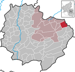
show Location of Stetten within Donnersbergkreis district | |
 Stetten | |
| Coordinates: 49°40′19″N 8°5′38″E / 49.67194°N 8.09389°ECoordinates: 49°40′19″N 8°5′38″E / 49.67194°N 8.09389°E | |
| Country | Germany |
| State | Rhineland-Palatinate |
| District | Donnersbergkreis |
| Municipal assoc. | Kirchheimbolanden |
| Government | |
| • Mayor (2019–24) | Kai Uwe Angermayer[1] |
| Area | |
| • Total | 6.54 km2 (2.53 sq mi) |
| Elevation | 235 m (771 ft) |
| Population (2020-12-31)[2] | |
| • Total | 672 |
| • Density | 100/km2 (270/sq mi) |
| Time zone | UTC+01:00 (CET) |
| • Summer (DST) | UTC+02:00 (CEST) |
| Postal codes | 67294 |
| Dialling codes | 06355 |
| Vehicle registration | KIB |
| Website | www.kirchheimbolanden.de |


Stetten is a municipality in Rhineland-Palatinate, Germany. It is in the Kirchheimbolanden administrative unit (Verbandsgemeinde).
History[]
The first documented record of Stetten occurred in 835.
Stetten was very badly damaged by 1635 due to the Thirty Years' War.
The region of Stetten, Palatinate was previously a district of the Kingdom of Bavaria. It became part of Rhineland-Palatinate in 1946.
References[]
- ^ Direktwahlen 2019, Donnersbergkreis, Landeswahlleiter Rheinland-Pfalz, accessed 9 August 2021.
- ^ "Bevölkerungsstand 2020, Kreise, Gemeinden, Verbandsgemeinden". Statistisches Landesamt Rheinland-Pfalz (in German). 2021.
External links[]
- www.kirchheimbolanden.de — official website (in German)
- www.ngw.nl — coat of arms
- www.tus-stetten.de — TuS 1860 Stetten/Pfalz e. V. (in German)
| show Towns and municipalities in Donnersbergkreis |
|---|
| Authority control |
|---|
This Donnersbergkreis location article is a stub. You can help Wikipedia by . |
Categories:
- Municipalities in Rhineland-Palatinate
- Donnersbergkreis
- Donnersbergkreis geography stubs