Stob a' Choin
| Stob a' Choin | |
|---|---|
 Stob a'Choin from the | |
| Highest point | |
| Elevation | 869 m (2,851 ft)[1] |
| Prominence | 480 m (1,570 ft) |
| Listing | Corbett, Marilyn |
| Coordinates | 56°18′37″N 4°33′40″W / 56.3104°N 4.5610°WCoordinates: 56°18′37″N 4°33′40″W / 56.3104°N 4.5610°W |
| Geography | |
| Location | Stirling, Scotland |
| Parent range | Grampian Mountains |
| OS grid | NN417159 |
| Topo map | OS Landranger 56 |

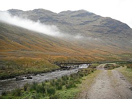
Stob a'Choin (869 m) is a mountain in the Grampian Mountains, Scotland, north of Loch Katrine in the Loch Lomond and The Trossachs National Park.
The nearest village is Balquhidder.[2]
References[]
- ^ "Stob a' Choin". hill-bagging.co.uk. Retrieved 7 May 2019.
- ^ "walkhighlands Stob a'Choin". walkhighlands.co.uk. Retrieved 7 May 2019.
This Scottish location article is a stub. You can help Wikipedia by . |
Categories:
- Mountains and hills of Stirling (council area)
- Marilyns of Scotland
- Corbetts
- Mountains and hills of the Southern Highlands
- Scotland geography stubs