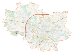
Strachowice, Wrocław
Strachowice | |
|---|---|
Former osiedle | |
 Copernicus Airport Wrocław - Terminal T2 | |
 Strachowice | |
| Coordinates: 51°06′35″N 16°52′50″E / 51.10972°N 16.88056°ECoordinates: 51°06′35″N 16°52′50″E / 51.10972°N 16.88056°E | |
| Voivodeship | Lower Silesian |
| County | Wrocław County |
| Gmina | Wrocław |
| First mentioned | 1305 |
| Within city limits | 1973 |
| Elevation | 123 m (404 ft) |
| Time zone | UTC+1 (CET) |
| • Summer (DST) | UTC+2 (CEST) |
| Vehicle registration | DW, DX |
| Primary airport | Copernicus Airport Wrocław |


Strachowice is a neighborhood in Wrocław, Poland, located in the southwestern part of the city. Originally a village, it was included within the city limits of Wrocław in 1973.[1]
The Copernicus Airport Wrocław is located in Strachowice.
History and etymology[]
Strachowice dates back to medieval Piast-ruled Poland. The oldest known mention of the village comes from a document from 1305.[1] Its name is of Polish origin, and comes from the Polish word strach, which means "fear".
In the 18th century it was annexed by Prussia, and in 1871 it became part of Germany. In 1937, during a massive Nazi campaign of renaming of placenames, it was renamed to Schöngarten to erase traces of Polish origin. During World War II, the Germans operated the E182 forced labour subcamp of the Stalag VIII-B/344 prisoner-of-war camp in the settlement.[2] Following the defeat of Germany in the war, in 1945, the village became again part of Poland and its historic name was restored.
In 1973 Strachowice was included in the city limits of Wrocław.[1] Until 1990 it was a neighborhood (osiedle) in the south-western part of Wrocław, in the district of Fabryczna. Since 1990 part of the combined osiedle Jerzmanowo-Jarnołtów-Strachowice-Osiniec.
Climate[]
| Climate data for Wrocław (Copernicus Airport Wrocław), elevation: 120 m, 1961-1990 normals and extremes | |||||||||||||
|---|---|---|---|---|---|---|---|---|---|---|---|---|---|
| Month | Jan | Feb | Mar | Apr | May | Jun | Jul | Aug | Sep | Oct | Nov | Dec | Year |
| Record high °C (°F) | 14.9 (58.8) |
19.7 (67.5) |
25.2 (77.4) |
29.5 (85.1) |
31.0 (87.8) |
32.8 (91.0) |
36.2 (97.2) |
35.0 (95.0) |
31.8 (89.2) |
28.1 (82.6) |
20.6 (69.1) |
16.4 (61.5) |
36.2 (97.2) |
| Average high °C (°F) | 1.3 (34.3) |
3.2 (37.8) |
7.9 (46.2) |
13.6 (56.5) |
18.8 (65.8) |
22.0 (71.6) |
23.4 (74.1) |
23.2 (73.8) |
19.3 (66.7) |
14.1 (57.4) |
7.4 (45.3) |
3.0 (37.4) |
13.1 (55.6) |
| Daily mean °C (°F) | −1.8 (28.8) |
−0.5 (31.1) |
3.2 (37.8) |
8.0 (46.4) |
13.1 (55.6) |
16.5 (61.7) |
17.7 (63.9) |
17.2 (63.0) |
13.4 (56.1) |
8.9 (48.0) |
3.9 (39.0) |
0.2 (32.4) |
8.3 (47.0) |
| Average low °C (°F) | −5.3 (22.5) |
��4.0 (24.8) |
−0.9 (30.4) |
2.8 (37.0) |
7.1 (44.8) |
10.7 (51.3) |
12.0 (53.6) |
11.6 (52.9) |
8.7 (47.7) |
4.6 (40.3) |
0.6 (33.1) |
−3.1 (26.4) |
3.7 (38.7) |
| Record low °C (°F) | −30.0 (−22.0) |
−27.0 (−16.6) |
−23.8 (−10.8) |
−8.1 (17.4) |
−4.0 (24.8) |
0.2 (32.4) |
3.6 (38.5) |
2.1 (35.8) |
−3.0 (26.6) |
−7.6 (18.3) |
−18.2 (−0.8) |
−24.4 (−11.9) |
−30.0 (−22.0) |
| Average precipitation mm (inches) | 28 (1.1) |
26 (1.0) |
26 (1.0) |
39 (1.5) |
64 (2.5) |
80 (3.1) |
84 (3.3) |
78 (3.1) |
48 (1.9) |
40 (1.6) |
43 (1.7) |
34 (1.3) |
590 (23.1) |
| Average precipitation days (≥ 1.0 mm) | 7.3 | 6.6 | 7.2 | 7.7 | 9.6 | 10.0 | 9.7 | 8.4 | 7.9 | 7.1 | 9.2 | 8.6 | 99.3 |
| Mean monthly sunshine hours | 49.0 | 65.0 | 107.0 | 142.0 | 198.0 | 194.0 | 205.0 | 197.0 | 139.0 | 108.0 | 52.0 | 39.0 | 1,495 |
| Source: NOAA[3] | |||||||||||||
References[]
- ^ a b c Antkowiak, Zygmunt (1991). Wrocław od A do Z. Wrocław-Warszawa-Kraków: Ossolineum. p. 313. ISBN 83-04-03723-8.
Strachowice, osiedle w dzielnicy Fabrycznej, wzmiankowane po raz pierwszy w 1305 r. Zapis z 1330 r. stwierdza, iż w Stachowicach znajdował się "dwór, czyli folwark", do którego należało 7 morgów ziemi. W 1345 r. Zygfryd z Żyrowa otrzymał w Strachowicach 8 łanów za roczny czynsz, a ponadto sądy wszelkie służby oraz 6 łanów chłopskich. W tamtych czasach miejscowy folwark był też gródkiem. Wedle Księgi ziemskiej (1353) nie określony bliżej pan Paweł miał we wsi 7 łanów folwarcznych, Mikołaj Żyrowski 5 łanów, a so��tys 2 łany. Przyjaciółka Goethego Karolina von Stein odnotowała, że gdy w 1803 r. była w Strachowicach. miejscowe dziewczęta "śpiewały także polskie pieśni". Pod naporem wojsk radzieckich hitlerowcy oddali Strachowice 16 II 1945 r., tracąc jednocześnie lotnisko wojskowe. Do Wrocławia wieś została przyłączona 1 I 1973 r. Obok starej zabudowy wiejskiej w ostatnim 40-leciu powstało tu trochę domków jednorodzinnych.
- ^ "Working Parties". Lamsdorf.com. Archived from the original on 29 October 2020. Retrieved 11 November 2021.
- ^ "Wroclaw(12424) - WMO Weather Station". NOAA. Retrieved December 31, 2018. Archived December 27, 2018, at the Wayback Machine.
- Districts of Wrocław