Strines
| Strines | |
|---|---|
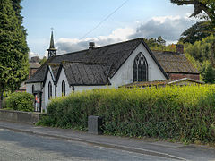 St Paul's Church, Strines | |
 Strines Location within Greater Manchester | |
| OS grid reference | SJ973863 |
| Metropolitan borough | |
| Metropolitan county | |
| Region | |
| Country | England |
| Sovereign state | United Kingdom |
| Post town | STOCKPORT |
| Postcode district | SK6 |
| Dialling code | 0161 |
| Police | Greater Manchester |
| Fire | Greater Manchester |
| Ambulance | North West |
| UK Parliament | |

Strines is a village in Greater Manchester, in the valley of the River Goyt midway between Marple and New Mills and about six miles southeast of Stockport. The village falls within Marple parish and the Stockport metropolitan borough. Immediately surrounding Strines are the villages of Woodend, Hague Bar and Brookbottom, where there is a Conservation area. Close by are the towns of Marple and New Mills and the villages of Mellor and Rowarth. Nearby is the hamlet of Turf Lea.
It is served by Strines railway station on the Hope Valley Line.
Strines Print Works[]

Strines had a print works from 1792 to 2001. From 1899 it was one of the Calico Printers' Association mills. The works reservoir remains, with a Grade II listed[1] "Chinese" dovecote in its centre dating from at least 1853.[2]
See also[]
References[]
- ^ Historic England. "The Chinese Dovecot on island in lake to premises occupied by English Calico Limited (Grade II) (1088124)". National Heritage List for England. Retrieved 26 March 2021.
- ^ "Strines Print Works" (PDF). New Mills History Society. 11 December 2003.
{{cite web}}: CS1 maint: url-status (link)
External links[]
| Wikimedia Commons has media related to Strines. |
- Villages in Greater Manchester
- Towns and villages of the Peak District
- Geography of the Metropolitan Borough of Stockport