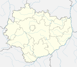
Sudół, Ostrowiec County
Sudół | |
|---|---|
Village | |
 Forestry in Sudół | |
 Sudół | |
| Coordinates: 50°58′10″N 21°28′21″E / 50.96944°N 21.47250°ECoordinates: 50°58′10″N 21°28′21″E / 50.96944°N 21.47250°E | |
| Country | |
| Voivodeship | Świętokrzyskie |
| County | Ostrowiec |
| Gmina | Gmina Bodzechów |
| Population | 670 |
| Time zone | UTC+1 (CET) |
| • Summer (DST) | UTC+2 (CEST) |
| Vehicle registration | TOS |
Sudół [ˈsuduu̯] is a village in the administrative district of Gmina Bodzechów, within Ostrowiec County, Świętokrzyskie Voivodeship, in south-central Poland. It lies approximately 7 kilometres (4 mi) north-east of Ostrowiec Świętokrzyski and 61 km (38 mi) east of the regional capital Kielce.[1]
The village has a population of 670.
The Krzemionki Prehistoric Striped Flint Mining Region, a UNESCO World Heritage Site and Historic Monument of Poland is located in Sudół.[2]
During the January Uprising, on May 4, 1863, the village was the site of a battle, in which Polish insurgents led by Dionizy Czachowski defeated the Russians.[3]
References[]
- ^ "Central Statistical Office (GUS) – TERYT (National Register of Territorial Land Apportionment Journal)" (in Polish). 2008-06-01.
- ^ Zarządzenie Prezydenta Rzeczypospolitej Polskiej z dnia 8 września 1994 r. w sprawie uznania za pomnik historii., Dz. U. z 1994 r. Nr 50, poz. 419
- ^ "157. rocznica wybuchu Powstania Styczniowego". Krzemionki.pl (in Polish). Retrieved 6 February 2021.
Categories:
- Villages in Ostrowiec County
- Ostrowiec County geography stubs


