Sukomobanare Island
 Aerial view of Sukomobanare in 2008 | |
 | |
| Geography | |
| Location | East China Sea |
| Coordinates | 28°07′06″N 129°10′07″E / 28.11833°N 129.16861°ECoordinates: 28°07′06″N 129°10′07″E / 28.11833°N 129.16861°E |
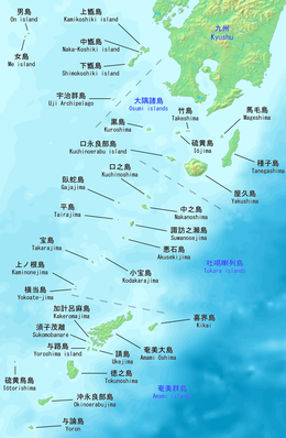
| Archipelago | Amami Islands |
| Highest elevation | 152 m (499 ft) |
| Administration | |
Japan | |
| Prefectures | Kagoshima Prefecture |
| District | Ōshima District |
| Demographics | |
| Ethnic groups | Ryukyuan, Japanese |
Sukomobanare Island (Japanese: 須子茂離島) is one of the islands of Amami Islands of Satsunan Islands, Japan, administratively belongs to Setouchi, Ōshima District, Kagoshima Prefecture. It is about 6.4 kilometers from south of , and about 5.6 kilometers southwest of Sukomo Village on western Kakeroma Island. It is rectangular in shape with 2 kilometers long and 400 to 700 meters wide.[1]
See also[]
- Desert island
- List of islands
References[]
This Kagoshima Prefecture location article is a stub. You can help Wikipedia by . |
Categories:
- Kagoshima geography stubs
- Amami Islands
- Islands of Kagoshima Prefecture
- Satsunan Islands
- Uninhabited islands of Japan