Sungi River
| Sungi River Sungai Sungi | |
|---|---|
| Native name | Tukad Sungi |
| Location | |
| Country | Indonesia |
| State | Bali |
| Physical characteristics | |
| Mouth | Yeh Sungi[1] |
• location | Badung Regency |
• elevation | 6 m (20 ft) |

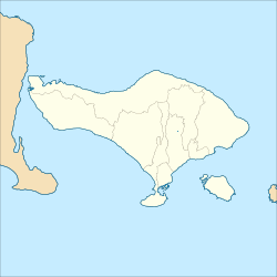
The Sungi River is a river on Bali, Indonesia.[2][3] Its source is located in the mountainous area in the central-northern part of Bali. It flows through the ancient site of Mengwi and enters the sea to the west of Kerobokan Kelod on the southern coast.[4]
The Sungi River forms most of the eastern boundary of the Tabanan Regency and provides irrigation water for 4,200 ha of sawah (rice paddies) within one regency (kabupaten) alone.
History[]
The first King of Mengwi, the Lord of Balayu, built a dam over the Sungi River.[5] According to Henk Schulte Nordholt, this dam was very important for the economy along the river bank, providing needed irrigation for the people to prosper.[4]
Geography[]
The river flows in the middle to the south of Bali with predominantly tropical rainforest climate (designated as Af in the Köppen-Geiger climate classification).[6] The annual average temperature in the area is 24 °C. The warmest month is October, when the average temperature is around 25 °C, and the coldest is July, at 22 °C.[7] The average annual rainfall is 2123 mm. The wettest month is January, with an average of 569 mm rainfall, and the driest is September, with 23 mm rainfall.[8]
| Sungi River | ||||||||||||||||||||||||||||||||||||||||||||||||||||||||||||
|---|---|---|---|---|---|---|---|---|---|---|---|---|---|---|---|---|---|---|---|---|---|---|---|---|---|---|---|---|---|---|---|---|---|---|---|---|---|---|---|---|---|---|---|---|---|---|---|---|---|---|---|---|---|---|---|---|---|---|---|---|
| Climate chart (explanation) | ||||||||||||||||||||||||||||||||||||||||||||||||||||||||||||
| ||||||||||||||||||||||||||||||||||||||||||||||||||||||||||||
| ||||||||||||||||||||||||||||||||||||||||||||||||||||||||||||
See also[]
References[]
- ^ Yeh Sungi at Geonames.org (cc-by); Last updated 17 January 2012; Database dump downloaded 27 November 2015
- ^ Rand McNally, The New International Atlas, 1993.
- ^ Tukad Sungi at Geonames.org (cc-by); Last updated 17 January 2012; Database dump downloaded 27 November 2015
- ^ Jump up to: a b J. Stephen Lansing, Murray P. Cox, Sean S. Downey, Marco A. Janssen and John W. Schoenfelder (2009). "A robust budding model of Balinese water temple networks". World Archaeology. 41: 112–133. doi:10.1080/00438240802668198. S2CID 4821372.CS1 maint: multiple names: authors list (link)
- ^ Nordholt, Henk Schulte (1996). The Spell of Power: A History of Balinese Politics, 1650–1940. KITLV Press. p. 58. ISBN 90-6718-090-4.
- ^ Peel, M C; Finlayson, B L; McMahon, T A (2007). "Updated world map of the Köppen-Geiger climate classification". Hydrology and Earth System Sciences. 11 (5): 1633–1644. doi:10.5194/hess-11-1633-2007.
- ^ Jump up to: a b "NASA Earth Observations Data Set Index". NASA. 30 January 2016.
- ^ "NASA Earth Observations: Rainfall (1 month – TRMM)". NASA/Tropical Rainfall Monitoring Mission. 30 January 2016.
- Rivers of Bali
- Rivers of Indonesia
