Surduk
Surduk
Сурдук (Serbian) | |
|---|---|
Village (Selo) | |
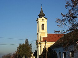 The Orthodox church of St.Nicholas | |
 Surduk | |
| Coordinates: 45°05′N 20°19′E / 45.083°N 20.317°E | |
| Country | |
| Province | |
| Region | Syrmia |
| District | Srem |
| Municipality | Stara Pazova |
| Area | |
| • Total | 134 sq mi (346 km2) |
| Elevation | 358 ft (109 m) |
| Population (2002) | |
| • Total | 1,589 |
| • Density | 1,190/sq mi (459/km2) |
| Time zone | UTC+1 (CET) |
| • Summer (DST) | UTC+2 (CEST) |
| Area code(s) | (+381) 022 |

Surduk (Serbian Cyrillic: Сурдук) is a village in Serbia. It is situated in the Stara Pazova municipality, in the Srem District, Vojvodina province. The village has a Serb ethnic majority and its population numbering 1,589 people (2002 census).
Name[]
Surduk derives its name from the Turkish word for the cliffs near the Danube river. In ancient times it was known as Rittium. In Croatian it is known as Surduk, and in Hungarian as Szurdok.
Ethnic groups (2002 census)[]
- Serbs = 1,463 (92.07%)
- Roma = 61
- Slovaks = 10
- Greek = 1
- others (including Hungarians, Croats, etc.).
Historical population[]
- 1961: 1,782
- 1971: 1,467
- 1981: 1,332
- 1991: 1,253
See also[]
- Site of Surduk
- List of places in Serbia
- List of cities, towns and villages in Vojvodina
References[]
- Slobodan Ćurčić, Broj stanovnika Vojvodine, Novi Sad, 1996.
Coordinates: 45°05′N 20°19′E / 45.083°N 20.317°E
| Wikimedia Commons has media related to Surduk. |
| show Authority control |
|---|
This Syrmia District, Vojvodina location article is a stub. You can help Wikipedia by . |
Categories:
- Populated places in Syrmia
- Syrmia District geography stubs