Surma Rural Municipality
Surma Rural Municipality
सुर्मा गाउँपालिका | |
|---|---|
 Surma Rural Municipality सुर्मा गाउँपालिका | |
| Coordinates: 29°40′43″N 81°07′37″E / 29.6786°N 81.1269°ECoordinates: 29°40′43″N 81°07′37″E / 29.6786°N 81.1269°E | |
| Country | |
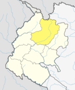
| Province | Sudurpashchim Province |
| District | Bajhang District |
| Government | |
| • Type | Local government |
| Area | |
| • Total | 270.8 km2 (104.6 sq mi) |
| Population | |
| • Total | 9,022 |
| • Density | 33/km2 (86/sq mi) |
| Time zone | UTC+05:45 (Nepal Standard Time) |
| Website | http://sunaryamun.gov.np |

Surma (Nepali: सुर्मा ) is a Gaupalika(Nepali: गाउपालिका ; gaupalika) in Bajhang District in the Sudurpashchim Province of far-western Nepal.[1]
Surma has a population of 9022.The land area is 270.8 km2.[2]
References[]
- ^ "Ministry of Federal Affairs". Retrieved 6 July 2020.
- ^ "National Population and Housing Census 2011(National Report)" (PDF). Central Bureau of Statistics. Government of Nepal. 2012. Archived from the original (PDF) on 2013-04-18. Retrieved 2012-01-01.
Categories:
- Rural municipalities of Nepal established in 2017
- Rural municipalities in Bajhang District