Tázlár
This article needs additional citations for verification. (December 2009) |
Tázlár | |
|---|---|
| Country | |
| County | Bács-Kiskun |
| Area | |
| • Total | 7,338 km2 (2,833 sq mi) |
| Population (2001) | |
| • Total | 2,014 |
| • Density | 27/km2 (70/sq mi) |
| Time zone | UTC+1 (CET) |
| • Summer (DST) | UTC+2 (CEST) |
| Postal code | 6236 |
| Area code(s) | 78 |
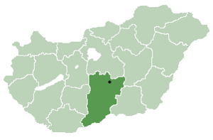
Tázlár is a village and municipality in Bács-Kiskun county, in the Southern Great Plain region of southern Hungary. It is about 10 km away from its closest neighbor, Soltvadkert.
Geography[]
This section is empty. You can help by . (July 2010) |
History[]
Tázlár's name was changed to Prónayfalva in 1907, but since 1947 it's called Tázlár again. The village was studied in the 1970s by anthropologist Chris Hann, resulting in a book "Tázlár: A village in Hungary".[1] He has returned there in 2000s studying the further developments The New Property System in Tázlár
Demographics[]
Ethnicity[]
As of the census of 2001 there were 2,014 people living in Tázlár. The ethnical background of the town was 95.1% Hungarian, 0.7% Gypsy, 0.2% Slovak, 4.5% other.
Religion[]
The religious affiliations of the people of Tázlár are:
- Roman Catholic - 65.9%
- Presbyterian - 16.1%
- Lutheran - 6.5%
- Other Christian - 0.9%
- Non-Religious - 10.5%


Coordinates: 46°33′N 19°31′E / 46.550°N 19.517°E

- ^ Hann, Chris 1980. Tázlár: a village in Hungary, Cambridge: Cambridge University Press
| show Authority control |
|---|
This Bács-Kiskun location article is a stub. You can help Wikipedia by . |
- Populated places in Bács-Kiskun County
- Bács-Kiskun County geography stubs